Special Weather Statement issued October 21 at 4:34PM EDT by NWS Wilmington OH (details ...)
At 434 PM EDT, strong thunderstorms were located along a line extending from near Delphos to near Versailles, moving east at 40 mph.
HAZARD...Wind gusts up to 45 mph.
SOURCE...Radar indicated.
IMPACT...Gusty winds could knock down tree limbs and blow around unsecured objects.
Locations impacted include... Sidney, Wapakoneta, St. Marys, Ada, Fort Shawnee, New Bremen, Minster, Newport, Cridersville, Anna, Fort Loramie, Jackson Center, Russells Point, De Graff, Botkins, Lakeview, New Knoxville, Alger, Waynesfield, and Chippewa Park.
This includes I-75 in Ohio between mile markers 91 and 118.
If outdoors, consider seeking shelter inside a sturdy building.
To report hazardous weather conditions, go to our website at weather.gov/iln and submit your report via social media, when you can do so safely.
Today 63° Today 63° chance 42° 42° slight chance Tomorrow 54° Tomorrow 54° slight chance 38° 38° slight chance
Saturday, June 21st, 2008
Photo by Shelley Grieshop/The Daily Standard

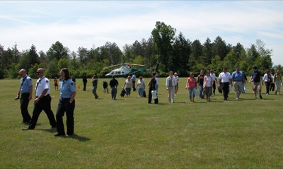
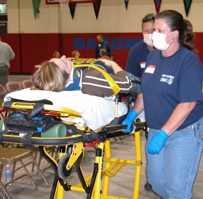
Paramedics, firefighters and other officials from hospitals, health departments, emergency management agencies, fire departments and squads in Mercer, Auglaize, Allen, Putman and Van Wert counties clear a landing field at the Ohio State Lima and Rhodes State College campus in Lima as an emergency medical helicopter prepares to take off. The activity was part of a pandemic flu exercise held in Lima on Friday.

Related online story:
Mercer County Health Department Administrator Dale Palmer headed up the five-county exercise that began weeks ago. The scenario was a pandemic flu ou [More]
Additional pictures on this date