The Daily Standard
Pictures Archive
Menu
▼
Home
Subscribe
E-Edition
Archives
▼
Archives
Obituary Archives
Photo Albums
Podcasts
▼
Podcasts
Video
Classifieds
▼
Classifieds
Public Notices
Weather
Sports
More
▼
Contacts
Advertising
Subscription Payment
Community Pictures
Historical Maps
Forms
Locations
Elections
65°
65°
slight
chance
Sun
80°
Sun
80°
61°
61°
Mon
83°
Mon
83°
Tuesday, July 21st, 2009
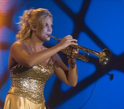
Photo by Mark Pummell/The Daily Standard
Miss Lake Festival Outstanding Teen 2009: Emily Werling
Archive of July 21st, 2009
Buy this E-Edition
Additional pictures on this date
<!--Unsupported browser-->
Copyright © 2026 Standard Printing Co. All Rights Reserved