Flood Watch issued August 14 at 2:57PM EDT until August 16 at 8:00AM EDT by NWS Wilmington OH (details ...)
* WHAT...Flash flooding caused by excessive rainfall is possible.
* WHERE...Portions of Indiana, including the following counties, Fayette, Franklin, Union and Wayne and Ohio, including the following counties, Auglaize, Butler, Champaign, Clark, Clinton, Darke, Delaware, Fairfield, Fayette, Franklin, Greene, Hardin, Hocking, Licking, Logan, Madison, Mercer, Miami, Montgomery, Pickaway, Preble, Ross, Shelby, Union and Warren.
* WHEN...From Saturday afternoon through Sunday morning.
* IMPACTS...Excessive runoff may result in flooding of rivers, creeks, streams, and other low-lying and flood-prone locations.
* ADDITIONAL DETAILS... - Another round of showers and thunderstorms is expected to move through the region Saturday into Saturday night. Given the saturated ground, additional heavy rainfall may result in flash flooding.
Today 82° Today 82° likely chance 70° 70° chance Tomorrow 84° Tomorrow 84° chance 74° 74° chance likely
Tuesday, July 16th, 2019
Photo by Colin Foster/The Daily Standard

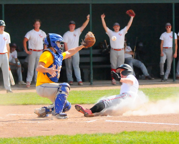
Van Wert's Owen Treece slides in safely at home as St. Marys catcher Ethan Wedding defends the plate during Monday's game at Shawnee High School.

Related online story:


SHAWNEE TOWNSHIP - Hits were beginning to fall for the St. Marys ACME team.
Then rain began to fall in Shawnee Township.
Van Wert held a 5-2 le [More]
Additional pictures on this date