Flood Watch issued August 15 at 10:48AM EDT until August 16 at 8:00AM EDT by NWS Wilmington OH (details ...)
* WHAT...Flash flooding caused by excessive rainfall continues to be possible.
* WHERE...Portions of Indiana, including the following counties, Fayette, Franklin, Union and Wayne and Ohio, including the following counties, Adams, Auglaize, Butler, Champaign, Clark, Clinton, Darke, Delaware, Fairfield, Fayette, Franklin, Greene, Hardin, Highland, Hocking, Licking, Logan, Madison, Mercer, Miami, Montgomery, Pickaway, Pike, Preble, Ross, Scioto, Shelby, Union and Warren.
* WHEN...Through Sunday morning.
* IMPACTS...Excessive runoff may result in flooding of rivers, creeks, streams, and other low-lying and flood-prone locations.
* ADDITIONAL DETAILS... - Additional rounds of showers and thunderstorms are expected today and tonight. Heavy rainfall is possible, especially tonight, which may result in flash flooding.
Today 81° Today 81° likely 73° 73° likely Tomorrow 83° Tomorrow 83° chance 70° 70° chance
Wednesday, September 16th, 2020
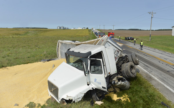
Wreck causes traffic congestion
Photo by Leslie Gartrell/The Daily Standard

An accident involving a Chevy Equinox and a commercial semi-trailer at the intersection of Celina-Mendon Road and U.S. Route 33 congested traffic on Tuesday afternoon. Both drivers refused treatment at the scene.

Additional pictures on this date