Special Weather Statement issued October 21 at 11:06AM EDT by NWS Wilmington OH (details ...)
Patchy dense fog with visibility of one quarter mile or less will be present this morning. The fog will continue to improve and will lift by early afternoon. Motorists should be prepared for rapid changes in visibility. Allow for greater distances between vehicles, use low beam headlights, and allow extra time to reach your destination.
Tuesday, December 7th, 2021
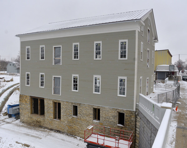
File Photo/The Daily Standard
This photo from a year ago shows the reservoir mill on the Miami-Erie Canal in St. Marys.
ST. MARYS - Money must be spent on a consultant to design the next phases of the High Street reservoir mill renovation project before construction can start, city council members were told on Monday. [More]