Flood Watch issued August 14 at 9:48PM EDT until August 16 at 8:00AM EDT by NWS Wilmington OH (details ...)
* WHAT...Flash flooding caused by excessive rainfall continues to be possible.
* WHERE...Portions of Indiana, including the following counties, Fayette, Franklin, Union and Wayne and Ohio, including the following counties, Auglaize, Butler, Champaign, Clark, Clinton, Darke, Delaware, Fairfield, Fayette, Franklin, Greene, Hardin, Hocking, Licking, Logan, Madison, Mercer, Miami, Montgomery, Pickaway, Preble, Ross, Shelby, Union and Warren.
* WHEN...From Saturday afternoon through Sunday morning.
* IMPACTS...Excessive runoff may result in flooding of rivers, creeks, streams, and other low-lying and flood-prone locations.
* ADDITIONAL DETAILS... - Another round of showers and thunderstorms is expected to move through the region Saturday into Saturday night. Additional heavy rainfall may result in flash flooding.
67° 67° Sat 84° Sat 84° slight chance likely 72° 72° likely Sun 86° Sun 86° chance
Monday, December 13th, 2021
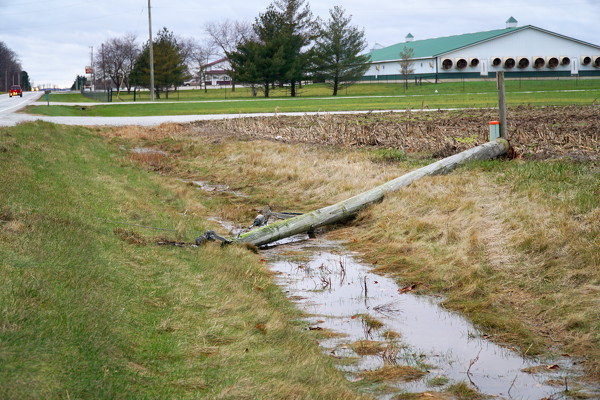
Lines down
Photo by Nancy Allen/The Daily Standard

This area dodged the worst of Friday's tornadoes and high winds. Lines from a downed utility pole lay across State Route 29 near Mack Arena on Saturday afternoon. The National Weather Service reported powerful wind gusts up to 45 miles per hour in the county. The Mercer County Sheriff's Office on Saturday also reported lines down on State Route 707 between Burrville and Wabash roads.


Additional pictures on this date