Special Weather Statement issued July 27 at 12:36PM EDT by NWS Wilmington OH (details ...)
At 1236 PM EDT, a strong thunderstorm was located near St. Marys, moving southeast at 25 mph.
HAZARD...Wind gusts up to 50 mph.
SOURCE...Radar indicated.
IMPACT...Gusty winds could knock down tree limbs and blow around unsecured objects.
Locations impacted include... St. Marys, New Bremen, Minster, Newport, Anna, Fort Loramie, Botkins, New Knoxville, Moulton, Chickasaw, Kettlersville, Montezuma, Egypt, Lake Loramie State Park, Maria Stein, Carthagena, Bulkhead, Mccartyville, and Houston.
This includes I-75 in Ohio between mile markers 101 and 107.
If outdoors, consider seeking shelter inside a sturdy building.
To report hazardous weather conditions, go to our website at weather.gov/iln and submit your report via social media, when you can do so safely.
Today 86° Today 86° likely 75° 75° chance Tomorrow 89° Tomorrow 89° slight chance 76° 76° slight chance
Saturday, September 30th, 2023
Photo by Paige Sutter/The Daily Standard

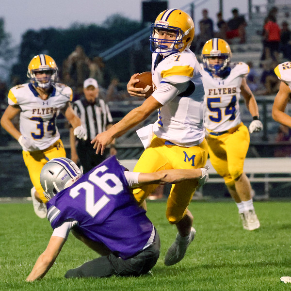
Marion Local's Justin Knouff tries to break a tackle by Fort Recovery linebacker Reece Wendel at Barrenbrugge Athletic Park on Friday.

Related online story:
FORT RECOVERY - Marion Local coach Tim Goodwin picked up his 300th career win as the Flyers extended their winning streak to 39 games on Friday. [More]
Additional pictures on this date