The Daily Standard
Story Archive

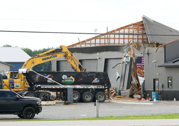
A roof at JB Truck Services and Parts at 4691 U.S. Route 127 was entirely ripped off during storms Wednesday night.
CELINA - Wednesday night's storms brought a little rain, and a lot of wind damage to the Grand Lake region and its surrounding areas, according to reports from local first responders and the National Weather Service.
"We had a widespread, but low-end, severe wind event," National Weather Service meteorologist John Franks said. "The stronger pockets of 60-70 mph wind-type damage was from east central Indiana into the Dayton Metro area and going up through (and) towards Celina as well. That is where a line of thunderstorms went through and they were particularly productive with the amount of wind being pushed in with them."
The non-tornadic storms yielded wind gusts that ranged from up to 69 mph in Dayton to gusts of up to 33 mph in Lima, Franks said. Rainfall came in at a low of .36 inches in Lima and a high of .75 inches in Dayton.
Unlike storm cells that are typically an isolated, oval shape, last night's storm was in a long linear formation on the radar, Franks said.
"And in this line, sometimes you'll have these little kinks that represent differences in wind speed, so it stops the moisture in the storms," he said. "It creates a little break in there. Well, with the differences in the wind speed, you get a circulation as the storm moves through and you can get a low end EF-0, possibly EF-1 tornado embedded in that line. But the problem is, unless we see the circulation from radar, it's almost impossible to determine that from a survey."
A roof at JB Truck Services and Parts at 4691 U.S. Route 127 was entirely ripped off during storms Wednesday night.
Pieces of the roof of the JB Truck Services and Parts' building came to rest on the ground on the other side of U.S. Route 127.
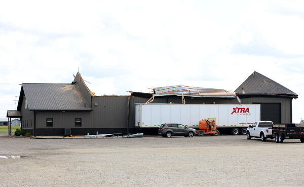
The high winds caused a myriad of wind damage. JB Truck Services and Parts' second location at 4691 U.S. Route 127 had its entire roof ripped off during the storms.
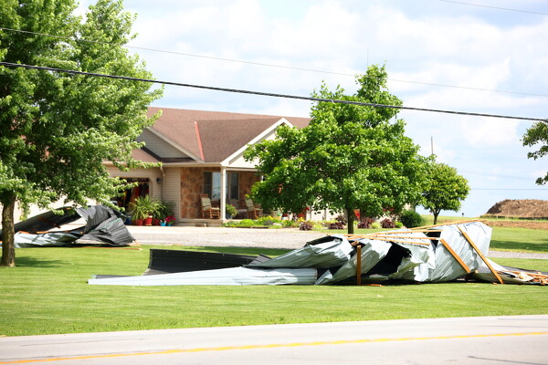
"There were some power lines down last night on top of some trees in Mendon," Mercer County Sheriff Doug Timmerman said. "Then we had the one building at (U.S. Route) 127 and (State Route) 219 that lost its roof. I had a report that I haven't got confirmed (that) there was some other barn damage down in the Maria Stein area as well. … And I know we also dispatched Fort Recovery fire into Darke County, I want to say near (State Route) 49 and Peters Road for some tree limb and power lines down."
The multiple reports of trees and lines down across Mercer and Darke counties included trees and limbs down on both the north lake and East Bank Park areas of Grand Lake.
Though this kind of wind damage is typically seen during tornadoes, Franks said it is also very common with the high-wind thunderstorms the area saw Wednesday night.
"You would think that, 'oh yeah, it had to have been a tornado that ripped the roof off of the building,' but no, they catch an edge and then you're off to the races with it once it catches," Franks said. "It's like water. Once it gets underneath something, it just kind of pulls it up."
The line of thunderstorms also traveled through Van Wert County, resulting in the worst wind damage Van Wert has seen in well over a decade, county emergency management director Rick McCoy said in a news release.
The storm carrying microburst winds that McCoy estimated at least reaching 70 mph eventually exited the city and flipped a semi on U.S. Route 30 near Stripe Road, per the release.
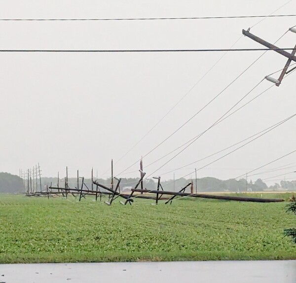
A view of snapped power poles in Van Wert County following a line of storms that passed through the area early Wednesday evening.
McCoy received several reports of a possible funnel that moved through the northeast part of Van Wert and a video recording confirmed within the microburst that it was producing a "gustnado," the release states.
"Damage was quite extensive in that northeast part of the city with numerous trees and power lines down," the release states. "A number of homes and cars were damaged by falling trees."
Strong winds also toppled the bell tower at St. Mary of the Assumption Catholic Church, McCoy reported.
"The bell tower at St. Marys Catholic Church was flattened along with some structural damage to the church," the release states. "A front door of the YMCA was shattered. The bell tower at St. Marks Lutheran Church was damaged. First Financial Bank had roof damage. (There was) front wall damage to H&R Block."
McCoy said this was the worst wind damage in the City of Van Wert since a derecho came through on June 29, 2012, though fortunately there were no injuries reported.