Severe Thunderstorm Watch issued May 19 at 4:39PM EDT until May 19 at 10:00PM EDT by NWS Wilmington OH (details ...)
THE NATIONAL WEATHER SERVICE HAS ISSUED SEVERE THUNDERSTORM WATCH 231 IN EFFECT UNTIL 10 PM EDT THIS EVENING FOR THE FOLLOWING AREAS
IN INDIANA THIS WATCH INCLUDES 6 COUNTIES
IN EAST CENTRAL INDIANA
FAYETTE UNION WAYNE
IN SOUTHEAST INDIANA
DEARBORN FRANKLIN RIPLEY
IN OHIO THIS WATCH INCLUDES 16 COUNTIES
IN CENTRAL OHIO
UNION
IN SOUTHWEST OHIO
BUTLER HAMILTON WARREN
IN WEST CENTRAL OHIO
AUGLAIZE CHAMPAIGN CLARK DARKE GREENE HARDIN LOGAN MERCER MIAMI MONTGOMERY PREBLE SHELBY
THIS INCLUDES THE CITIES OF ADA, AURORA, BATESVILLE, BEAVERCREEK, BELLEFONTAINE, BRIGHT, BROOKVILLE, CAMDEN, CELINA, COLDWATER, CONNERSVILLE, DILLSBORO, DOWNTOWN CINCINNATI, DOWNTOWN DAYTON, EATON, FAIRBORN, FAIRFIELD, FRANKLIN, GREENDALE, GREENVILLE, HAMILTON, HIDDEN VALLEY, KENTON, KETTERING, LANDEN, LAWRENCEBURG, LEBANON, LIBERTY, MARYSVILLE, MASON, MIDDLETOWN, MILAN, MINSTER, NEW BREMEN, OSGOOD, OXFORD, PIQUA, RICHMOND, SIDNEY, SPRINGBORO, SPRINGFIELD, ST. MARYS, TIPP CITY, TROY, URBANA, VERSAILLES, WAPAKONETA, WEST COLLEGE CORNER, AND XENIA.
Special Weather Statement issued May 19 at 6:18PM EDT by NWS Wilmington OH (details ...)
At 618 PM EDT, a strong thunderstorm was located over Wapakoneta, moving northeast at 35 mph.
HAZARD...Wind gusts up to 50 mph and pea size hail.
SOURCE...Radar indicated.
IMPACT...Gusty winds could knock down tree limbs and blow around unsecured objects. Hail may cause minor damage to vegetation.
Locations impacted include... Wapakoneta, Ada, Fort Shawnee, Cridersville, Dunkirk, Alger, Waynesfield, Blanchard, Roundhead, Mcguffey, Uniopolis, Dola, Fryburg, Jumbo, Huntersville, St. Johns, Walton, New Hampshire, and State Route 195 at State Route 235.
This includes I-75 in Ohio between mile markers 106 and 118.
If outdoors, consider seeking shelter inside a sturdy building.
A Severe Thunderstorm Watch remains in effect until 1000 PM EDT for west central Ohio.
To report hazardous weather conditions, go to our website at weather.gov/iln and submit your report via social media, when you can do so safely.
Special Weather Statement issued May 19 at 6:06PM EDT by NWS Wilmington OH (details ...)
At 605 PM EDT, a strong thunderstorm was located over New Knoxville, moving northeast at 35 mph.
HAZARD...Wind gusts up to 45 mph and half inch hail.
SOURCE...Radar indicated.
IMPACT...Gusty winds could knock down tree limbs and blow around unsecured objects. Hail may cause minor damage to vegetation.
Locations impacted include... Wapakoneta, St. Marys, Fort Shawnee, New Bremen, Minster, Cridersville, Botkins, New Knoxville, Waynesfield, Moulton, Buckland, Uniopolis, Kettlersville, Fryburg, Lake Loramie State Park, St. Johns, and Bulkhead.
This includes I-75 in Ohio between mile markers 104 and 118.
If outdoors, consider seeking shelter inside a sturdy building.
A Severe Thunderstorm Watch remains in effect until 1000 PM EDT for west central Ohio.
To report hazardous weather conditions, go to our website at weather.gov/iln and submit your report via social media, when you can do so safely.
Today 88° Today 88° slight chance chance 60° 60° likely Tomorrow 68° Tomorrow 68° chance 47° 47°
Saturday, November 1st, 2025
By Erin Gardner
CELINA - This year, don't let pumpkins and jack o' lanterns haunt the graveyards of garbage.
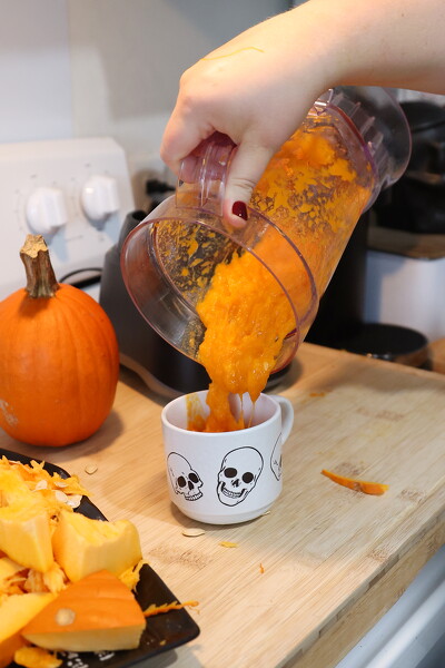
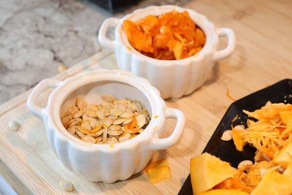
Instead, turn the tricks into treats by recycling the whole pumpkin - guts and all.

Feeding farm animals, pets
Jim Myers, owner of CountrySide Heritage Swine, a Celina-based pig farm, said pigs love the autumnal fruit. [More]
Obituaries on November 1st, 2025
Deb (Heuker) Giere, age 65, of Coldwater passed away peacefully, surrounded by family on October 30, 2025 at her home in Coldwater. [More]
Local pictures on November 1st, 2025
Subscriber stories on November 1st, 2025
CELINA - A pair of multimillion-dollar city projects should be wrapping up by the year's end, Celina Mayor Jeff Hazel informed city councilors at their regular meeting this week.
CELINA - The Mercer County Sheriff's Office is bringing up to date its fleet of vehicles and software programs.
The Mercer County Commissioners approved numerous requests from the sheriff's office in October, including the purchase of a 2026 Chevy Tahoe to be used as a marked patrol vehicle.
Lehman outlasts Minster 50-48 in playoff opener
SIDNEY - Minster and Lehman engaged each other in a back-and-forth shootout to begin their respective playoff runs.
In the second half, both offen
ST. MARYS - The officiating crew wiped away a fake field-goal touchdown by St. Marys in the third quarter Friday.
Fortunately, the Roughriders' Caleb Schmidt couldn't be kept out of the end zone in the fourth.
COLDWATER - A couple short fields kick-started the Coldwater offense and paved the way for a 48-0 win over Covington in the opening round of the Division VI regionals Friday night at Cavalier Stadium.
Compiled by Gary R. Rasberry
Fort Recovery made their trip to Cincinnati a successful one as the Indians won their first playoff game since 2021 with a 34-8 victory over Cincinnati College Prep Academy in the Division VII football playoffs on Friday at McNulty Stadium at Finneytown High School.