Flood Watch issued September 16 at 10:49PM EDT until September 17 at 2:00PM EDT by NWS Wilmington OH (details ...)
* WHAT...Flash flooding caused by excessive rainfall continues to be possible.
* WHERE...Portions of east central Indiana, including the following county, Wayne and Ohio, including the following counties, Auglaize, Champaign, Clark, Darke, Delaware, Franklin, Greene, Hardin, Licking, Logan, Madison, Mercer, Miami, Montgomery, Preble, Shelby and Union.
* WHEN...Through Thursday afternoon.
* IMPACTS...Excessive runoff may result in flooding of rivers, creeks, streams, and other low-lying and flood-prone locations.
* ADDITIONAL DETAILS... - Multiple rounds of rain are possible Thursday. The heavier bands of rainfall may produce 2 to 4 inches with locally higher amounts.
68° 68° chance Thu 84° Thu 84° likely 65° 65° slight chance Fri 77° Fri 77°
Wednesday, February 21st, 2007
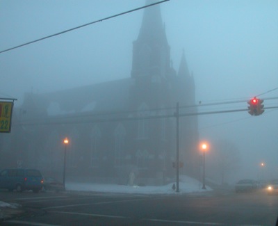
Freezing fog
Photo by Dave Heirholzer/The Daily Standard

Hoar frost creates a pretty scene in Celina this morning - along with slick sidewalks and driveways. Hoar frost is white ice crystals that form when the air is moist and the surface is cold, according to Wikipedia.

Additional pictures on this date