Heat Advisory issued June 26 at 3:14PM EDT until June 27 at 8:00PM EDT by NWS Wilmington OH (details ...)
* WHAT...Heat index values in the upper 90s to lower 100s.
* WHERE...Portions of east central and southeast Indiana, northeast and northern Kentucky, and central, south central, southwest, and west central Ohio.
* WHEN...Until 8 PM EDT Friday.
* IMPACTS...Hot temperatures and high humidity may cause heat illnesses.
* ADDITIONAL DETAILS...Consecutive days of high heat and humidity can be especially hazardous as warm overnight temperatures will provide little relief.
Special Weather Statement issued June 26 at 5:27PM EDT by NWS Wilmington OH (details ...)
At 527 PM EDT, a strong thunderstorm was located near Alger, moving east at 15 mph.
HAZARD...Wind gusts up to 45 mph and very heavy rain.
SOURCE...Radar indicated.
IMPACT...Gusty winds could knock down tree limbs and blow around unsecured objects. Visibility will be poor and hydroplaning is possible.
Locations impacted include... Kenton, Ada, Forest, Lakeview, Dunkirk, Alger, Waynesfield, Belle Center, Chippewa Park, Northwood, Blanchard, Roundhead, Mount Victory, Rushsylvania, Mcguffey, Ridgeway, Patterson, Dola, Huntersville, and Pfeiffer.
If outdoors, consider seeking shelter inside a sturdy building.
Motorists should slow down and use extra caution.
To report hazardous weather conditions, go to our website at weather.gov/iln and submit your report via social media, when you can do so safely.
Today 90° Today 90° chance 75° 75° chance Tomorrow 90° Tomorrow 90° likely 73° 73° likely chance
Thursday, February 22nd, 2007
Art Show
Photo by Janie Southard/The Daily Standard

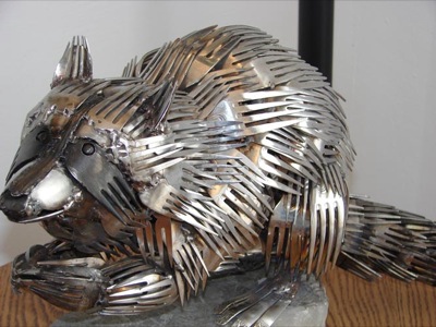
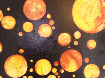
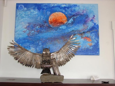
The new 'Silver & Bold' art show at Arts Place St. Marys will continue through March 10. The work of painter Marge Brandt and sculptor Gary Hovey is on display. Above are some of Brandt's abstracts and Hovey's animals made of eating utensils.

Additional pictures on this date