Special Weather Statement issued May 1 at 12:13PM EDT by NWS Wilmington OH (details ...)
At 1212 PM EDT, a strong thunderstorm was located near New Bremen, moving northeast at 50 mph.
HAZARD...Wind gusts up to 45 mph and pea size hail.
SOURCE...Radar indicated.
IMPACT...Gusty winds could knock down tree limbs and blow around unsecured objects. Hail may cause minor damage to vegetation.
Locations impacted include... Newport, Fryburg, Montra, Egypt, Uniopolis, New Bremen, Buckland, Botkins, New Knoxville, Fort Loramie, Kettlersville, Moulton, Jackson Center, St. Marys, Anna, Kossuth, Lakeview, Lake Loramie State Park, Waynesfield, and Wapakoneta.
This includes I-75 in Ohio between mile markers 96 and 118.
If outdoors, consider seeking shelter inside a sturdy building.
To report hazardous weather conditions, go to our website at weather.gov/iln and submit your report via social media, when you can do so safely.
Today 74° Today 74° 58° 58° chance Tomorrow 71° Tomorrow 71° chance 54° 54° chance
Wednesday, June 11th, 2008
Firefighters battle blaze at rural Mercer County home
Photo by Janie Southard/The Daily Standard

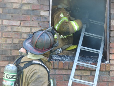
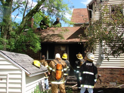
Firefighters from Chattanooga, Celina, Rockford and Mendon were on the scene Tuesday morning at a house fire in Liberty Township. The rural home of Shawn and Michelle Franck on Township Line Road was heavily damaged by heat and smoke, according to Lt. Doug Walters of the Celina department. None of the family was home at the time of the fire. Chatt Fire Chief Doug Brehm was not available by press time to provide further information.

Additional pictures on this date