Flood Watch issued September 17 at 2:22AM EDT until September 17 at 2:00PM EDT by NWS Wilmington OH (details ...)
* WHAT...Flash flooding caused by excessive rainfall continues to be possible.
* WHERE...Portions of central and west central Ohio, including the following counties, in central Ohio, Delaware, Franklin, Licking, Madison and Union. In west central Ohio, Auglaize, Champaign, Clark, Darke, Hardin, Logan, Mercer, Miami and Shelby.
* WHEN...Until 2 PM EDT this afternoon.
* IMPACTS...Excessive runoff may result in flooding of rivers, creeks, streams, and other low-lying and flood-prone locations.
* ADDITIONAL DETAILS... - Multiple rounds of showers and thunderstorms will move across parts of the area this morning, possibly extending into early afternoon. This may result in bands of heavier rainfall that could lead to flash flooding.
68° 68° chance Thu 84° Thu 84° likely 65° 65° slight chance Fri 77° Fri 77°
Friday, January 9th, 2009
Photo by Mark Pummell/The Daily Standard

Mercer County Commissioner Jerry Laffin points toward a dredge material relocation area under construction on county land near Montezuma, as commissioners Bob Nuding, far left, and John Bruns, far right look on. Brian Miller, assistant manager of Grand Lake St. Marys State Park, center, showed commissioners the site Thursday morning and explained the project.

Related online story:

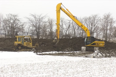
Mercer County commissioners Thursday morning viewed a 15-acre, county-owned parcel on which dredge material from a portion of Beaver Creek will be placed. [More]
Additional pictures on this date