Severe Thunderstorm Watch issued March 31 at 6:02PM EDT until April 1 at 12:00AM EDT by NWS Wilmington OH (details ...)
THE NATIONAL WEATHER SERVICE HAS ISSUED SEVERE THUNDERSTORM WATCH 82 IN EFFECT UNTIL MIDNIGHT EDT TONIGHT FOR THE FOLLOWING AREAS
IN OHIO THIS WATCH INCLUDES 3 COUNTIES
IN WEST CENTRAL OHIO
AUGLAIZE HARDIN MERCER
THIS INCLUDES THE CITIES OF ADA, CELINA, COLDWATER, KENTON, MINSTER, NEW BREMEN, ST. MARYS, AND WAPAKONETA.
Today 78° Today 78° chance 52° 52° chance Tomorrow 60° Tomorrow 60° 47° 47° likely
Tuesday, July 3rd, 2012
Storm damage
Photo by Frank Snyder/The Daily Standard

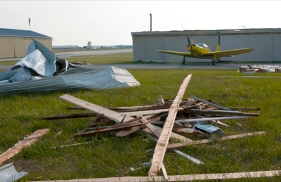
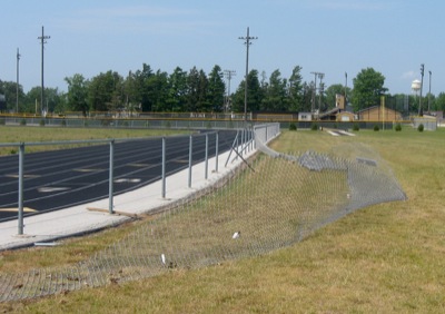
Debris litters Lakefield Airport, south of Celina, after a Friday afternoon storm that packed winds in excess of 80 mph. An empty hangar was destroyed and another building sustained considerable damage. Officials continue to assess the damage.

Additional pictures on this date