Cold Weather Advisory issued February 6 at 6:04PM EST until February 7 at 12:00PM EST by NWS Wilmington OH (details ...)
* WHAT...Very cold wind chills as low as 15 below zero expected.
* WHERE...Portions of east central Indiana and central, south central, southwest, and west central Ohio.
* WHEN...From 1 AM to noon EST Saturday.
* IMPACTS...The cold wind chills as low as 15 below zero could result in hypothermia if precautions are not taken.
Special Weather Statement issued February 6 at 1:56PM EST by NWS Wilmington OH (details ...)
Although snow has ended, some slick spots may remain on roadways. Additionally, gusty northwesterly winds could result in some blowing and drifting snow tonight.
Today 32° Today 32° heavy chance blowing Tomorrow 16° Tomorrow 16°
Thursday, July 11th, 2013
Photo by Amy Kronenberger/The Daily Standard

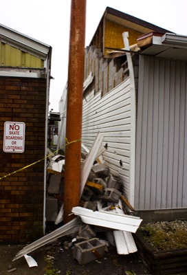
Above, emergency personnel from the Auglaize County Sheriff's office and the St. Marys Township Fire Department worked to block off county Road 66A between state Route 219 and Southland Road after 10 utility poles were uprooted during the storm Wednesday afternoon. The road remains closed today as crews work to replace the poles.

Related online story:
The powerful storm that ripped through Mercer and Auglaize counties Wednesday afternoon was akin to a weak tornado, reported Mike Kurz, a meteorologist with the National Weather Service in Wilmington. [More]
Additional pictures on this date