Air Quality Alert issued July 16 at 3:18PM EDT by NWS Wilmington OH (details ...)
The Ohio Environmental Protection Agency has issued a statewide Air Quality Advisory for the entire state of Ohio as smoke from Canadian wildfires continues to adversely impact air quality. Pollutants across the state are expected to range from the 'Unhealthy For Sensitive Groups' category in the southwest part of the state to the 'Unhealthy' category in the rest of the state. Hourly concentrations at times may reach the 'Very Unhealthy' to 'Hazardous' categories. It is recommended, when possible, to avoid strenuous outdoor activities, especially those with heart disease and respiratory conditions like asthma. Watch for symptoms including wheezing, coughing, chest tightness, dizziness, or burning in the nose, throat, and eyes. For additional information, please visit the Ohio Environmental Protection Agency's website at epa.ohio.gov.
Air Quality Alert issued July 16 at 2:18PM EDT by NWS Wilmington OH (details ...)
The Ohio Environmental Protection Agency has issued an Air Quality Advisory for the entire state of Ohio, until midnight EDT tonight. Smoke from Canadian wildfires will adversely impact air quality today. The Ohio Environmental Protection Agency expects the Air Quality Index to be in the 'unhealthy' range. For additional information, please visit the Ohio Environmental Protection Agency's website at epa.ohio.gov.
Air Quality Alert issued July 16 at 10:53AM EDT by NWS Wilmington OH (details ...)
The Ohio Environmental Protection Agency has issued an Air Quality Advisory for the entire state of Ohio, until midnight EDT tonight. Smoke from Canadian wildfires will adversely impact air quality today. The Ohio Environmental Protection Agency expects the Air Quality Index to be in the 'unhealthy' range. For additional information, please visit the Ohio Environmental Protection Agency's website at epa.ohio.gov.
Air Quality Alert issued July 16 at 9:21AM EDT by NWS Wilmington OH (details ...)
The Ohio Environmental Protection Agency has issued an Air Quality Advisory for the entire state of Ohio, until midnight EDT tonight. Smoke from Canadian wildfires will adversely impact air quality today. The Ohio Environmental Protection Agency expects the Air Quality Index to be in the 'unhealthy' range. For additional information, please visit the Ohio Environmental Protection Agency's website at epa.ohio.gov.
Air Quality Alert issued July 16 at 12:23AM EDT by NWS Wilmington OH (details ...)
The Ohio Environmental Protection Agency has issued an Air Quality Advisory for the entire state of Ohio, through midnight EDT tonight. Smoke from Canadian wildfires will adversely impact air quality. The Agency expects the Air Quality Index to be in the 'unhealthy for sensitive groups' range. For additional actions and information, please visit the Ohio Environmental Protection Agency's web site at epa.ohio.gov.
Air Quality Alert issued July 16 at 12:16AM EDT by NWS Wilmington OH (details ...)
The Ohio Environmental Protection Agency has issued an Air Quality Advisory for the entire state of Ohio, from 7 AM Thursday to midnight EDT tonight. Smoke from Canadian wildfires will adversely impact air quality. The Agency expects the Air Quality Index to be in the 'unhealthy for sensitive groups' range. For additional actions and information, please visit the Ohio Environmental Protection Agency's web site at epa.ohio.gov.
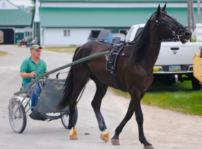
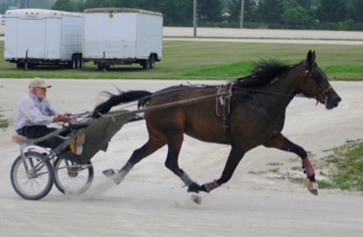
Friday, August 9th, 2013
Photo by Gary R. Rasberry/The Daily Standard
Steve Boroff takes Broadway Phantom out for a practice session at the Mercer County Fairgrounds.