The Daily Standard
Pictures Archive
Menu
▼
Home
Subscribe
E-Edition
Archives
▼
Archives
Obituary Archives
Photo Albums
Podcasts
▼
Podcasts
Video
Classifieds
▼
Classifieds
Public Notices
Weather
Sports
More
▼
Contacts
Advertising
Subscription Payment
Community Pictures
Historical Maps
Forms
Locations
Elections
Today
71°
Today
71°
62°
62°
Tomorrow
79°
Tomorrow
79°
chance
51°
51°
likely
Saturday, January 24th, 2015
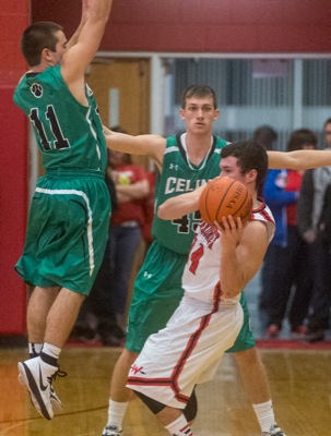
Photo by Mark Pummell/The Daily Standard
Issac Fitzgerald hit five three-pointers in the second half to help St. Marys defeat Bath.
Purchase a print of this photo.
Archive of January 24th, 2015
Buy this E-Edition
Additional pictures on this date
<!--Unsupported browser-->
Copyright © 2026 Standard Printing Co. All Rights Reserved