Flood Advisory issued August 19 at 3:55PM EDT until August 19 at 7:00PM EDT by NWS Wilmington OH (details ...)
* WHAT...Flooding caused by excessive rainfall is expected.
* WHERE...Southern Mercer County in west central Ohio...
* WHEN...Until 700 PM EDT.
* IMPACTS...Minor flooding in low-lying and poor drainage areas.
* ADDITIONAL DETAILS... - At 355 PM EDT, radar indicated heavy rain due to thunderstorms. Minor flooding is ongoing or expected to begin shortly in the advisory area. Between 1 and 1.5 inches of rain have fallen. Additional rainfall amounts of 0.5 to 1.5 inches are possible. - Some locations that may experience flooding include... Coldwater, St. Henry, Fort Recovery, Chickasaw, Burkettsville, Montezuma, Carthagena and Maria Stein.
Special Weather Statement issued August 19 at 3:30PM EDT by NWS Wilmington OH (details ...)
Showers and thunderstorms will be capable of producing brief cold air funnels this afternoon and evening. Several funnel clouds have already been spotted across west-central Ohio, with this feature potentially moving into central Ohio over the coming hours. Keep in mind, the majority of these funnels will not reach the ground, but if they do, gusty winds and minor damage may occur.
Flood Watch issued August 19 at 12:40PM EDT until August 20 at 10:00AM EDT by NWS Wilmington OH (details ...)
* WHAT...Flash flooding caused by excessive rainfall is possible.
* WHERE...Portions of east central Indiana, including the following counties, Fayette, Union and Wayne and Ohio, including the following counties, Auglaize, Champaign, Clark, Darke, Delaware, Fairfield, Fayette, Franklin, Greene, Hardin, Hocking, Licking, Logan, Madison, Mercer, Miami, Montgomery, Pickaway, Preble, Shelby and Union.
* WHEN...From 4 PM EDT this afternoon through Thursday morning.
* IMPACTS...Excessive runoff may result in flooding of rivers, creeks, streams, and other low-lying and flood-prone locations.
* ADDITIONAL DETAILS... - A complex of storms will develop later this afternoon and continue overnight. Repeated rounds of storms, combined with the extremely wet soil conditions will increase the risk for flash flooding later this evening into the overnight hours.
Flood Advisory issued August 19 at 4:25PM EDT until August 19 at 7:30PM EDT by NWS Wilmington OH (details ...)
* WHAT...Flooding caused by excessive rainfall is expected.
* WHERE...Southern Auglaize County in west central Ohio... Northwestern Logan County in west central Ohio... Shelby County in west central Ohio...
* WHEN...Until 730 PM EDT.
* IMPACTS...Minor flooding in low-lying and poor drainage areas. Water over roadways.
* ADDITIONAL DETAILS... - At 425 PM EDT, radar and automated rain gauges indicated heavy rain due to thunderstorms. Minor flooding is ongoing or expected to begin shortly in the advisory area. Between 0.5 and 1.5 inches of rain have fallen. Additional rainfall amounts of 1 to 2 inches are possible. - Some locations that may experience flooding include... Sidney, New Bremen, Minster, Newport, Anna, Fort Loramie, Jackson Center, Russells Point, Botkins, Lakeview, Hardin, Huntsville, Port Jefferson, Kettlersville, Swanders, Montra, Mccartyville, Maplewood, Pemberton and Lake Loramie State Park.
Today 77° Today 77° chance 63° 63° chance Tomorrow 77° Tomorrow 77° slight chance 60° 60°
Saturday, January 16th, 2016
Obituaries on January 16th, 2016
Florence E. Miller, 86, of Rockford, Ohio, died suddenly at Parkview Regional Medical Center on Thursday night, January 14, 2016. [More]
Joann M. Pax, age 77, of Coldwater, died on Thursday, January 14, 2016 at Celina Manor. [More]
Stories on January 16th, 2016
CELINA - Bones found south of the city are believed to be those of a man who likely was a homicide victim, Mercer County Sheriff Jeff Grey revealed Friday afternoon. [More]
CELINA - Florence LaRue waited 76 years to get her varsity band letter.
The 94-year-old, who graduated from Celina High School in 1939, played trum
CELINA - Mercer County's 2016 general fund appropriations are about 7.5 percent higher than last year's due to a variety of increased expenses across the board.
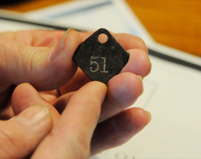
St. Marys man uncovers piece of foundry's past
ST. MARYS - An area history buff recently discovered a metal tag possibly used at a local foundry more than 150 years ago.
Steve Flaugher, a real e
NEW BREMEN - Both New Bremen coach Adam Dougherty and Minster coach Mike Lee had the same summation of their teams' rivalry game on Friday night: That's Minster vs. New Bremen. [More]
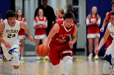
MARIA STEIN - To say St. Henry got off to quick start would be putting it mildly.
The Redskins raced out to a 27-10 first quarter lead and never looked back in a 66-47 Midwest Athletic Conference victory over the Marion Local Flyers Friday night at the Hangar.
FORT RECOVERY - Darien Sheffer faced the ultimate pressure situation on Friday night in Fort Recovery's game with Versailles: Two free throws with 1.2 seconds left to force overtime.
Compiled by Gary R. Rasberry
Defiance jumped out to a 23-9 lead after one quarter against Celina and never looked back as the defending Division II state champion posted a 63-37 victory on Friday night.
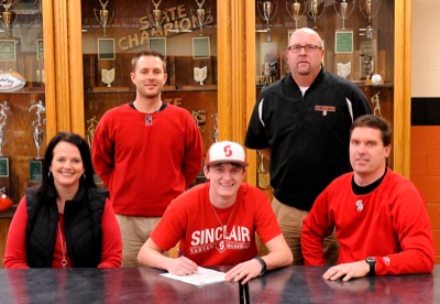
ST. HENRY - St. Henry seniors Mitchel Stammen and Josh Osterholt made their college decisions official on Friday afternoon.
Stammen, a three-sport
COLDWATER - After wrapping up his high school baseball career this upcoming spring, Aaron Harlamert will move on to work on his game with hopes of landing a bigger opportunity.
WBL Roundup
Compiled by Gary R. Rasberry
Elida outscored St. Marys 54-30 over the final three quarters to pick up its second win of the season with a 65-43 victory over the Roughriders at the Elida Fieldhouse on Friday night.
MAC Roundup
Compiled by Gary R. Rasberry
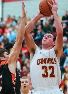
Coldwater jumped out to a 21-9 first quarter lead and never looked back as the Cavaliers remained unbeaten in the MAC with an 89-40 win over Parkway on Friday night in Rockford,
The Cavaliers shot 60 percent from the field and outrebounded the Panthers 45-26.

Local pictures on January 16th, 2016