Severe Thunderstorm Warning issued August 10 at 9:49PM EDT until August 10 at 10:30PM EDT by NWS Wilmington OH (details ...)
SVRILN
The National Weather Service in Wilmington has issued a
* Severe Thunderstorm Warning for... Northeastern Shelby County in west central Ohio... Southern Auglaize County in west central Ohio... Central Mercer County in west central Ohio...
* Until 1030 PM EDT.
* At 948 PM EDT, a severe thunderstorm was located near St. Marys, moving southeast at 45 mph.
HAZARD...60 mph wind gusts and quarter size hail.
SOURCE...Radar indicated.
IMPACT...Minor hail damage to vehicles is possible. Expect wind damage to trees and power lines.
* Locations impacted include... Celina, Wapakoneta, St. Marys, Coldwater, New Bremen, Minster, Anna, Jackson Center, Botkins, New Knoxville, Moulton, Wabash, Port Jefferson, Kettlersville, Montezuma, Fryburg, Montra, Tama, Neptune, and Maplewood.
This includes I-75 in Ohio between mile markers 96 and 112.
Severe Thunderstorm Warning issued August 10 at 9:29PM EDT until August 10 at 10:15PM EDT by NWS Wilmington OH (details ...)
SVRILN
The National Weather Service in Wilmington has issued a
* Severe Thunderstorm Warning for... Northwestern Auglaize County in west central Ohio... Northern Mercer County in west central Ohio...
* Until 1015 PM EDT.
* At 929 PM EDT, a severe thunderstorm was located near Ohio City, moving east at 35 mph.
HAZARD...60 mph wind gusts and quarter size hail.
SOURCE...Radar indicated.
IMPACT...Minor hail damage to vehicles is possible. Expect wind damage to trees and power lines.
* Locations impacted include... Wapakoneta, Fort Shawnee, Cridersville, Rockford, Mendon, Buckland, Uniopolis, Chattanooga, Kossuth, Tama, St. Johns, Neptune, and State Route 116 at State Route 197.
This includes I-75 in Ohio between mile markers 111 and 118.
Severe Thunderstorm Watch issued August 10 at 7:26PM EDT until August 11 at 2:00AM EDT by NWS Wilmington OH (details ...)
THE NATIONAL WEATHER SERVICE HAS ISSUED SEVERE THUNDERSTORM WATCH 560 IN EFFECT UNTIL 2 AM EDT TUESDAY FOR THE FOLLOWING AREAS
IN INDIANA THIS WATCH INCLUDES 1 COUNTY
IN EAST CENTRAL INDIANA
WAYNE
IN OHIO THIS WATCH INCLUDES 21 COUNTIES
IN CENTRAL OHIO
DELAWARE FAIRFIELD FAYETTE FRANKLIN HOCKING LICKING MADISON PICKAWAY UNION
IN WEST CENTRAL OHIO
AUGLAIZE CHAMPAIGN CLARK DARKE GREENE HARDIN LOGAN MERCER MIAMI MONTGOMERY PREBLE SHELBY
THIS INCLUDES THE CITIES OF ADA, BEAVERCREEK, BELLEFONTAINE, CAMDEN, CELINA, CIRCLEVILLE, COLDWATER, DELAWARE, DOWNTOWN COLUMBUS, DOWNTOWN DAYTON, EATON, FAIRBORN, GREENVILLE, KENTON, KETTERING, LANCASTER, LOGAN, LONDON, MARYSVILLE, MINSTER, NEW BREMEN, NEWARK, PICKERINGTON, PIQUA, PLAIN CITY, RICHMOND, SIDNEY, SPRINGFIELD, ST. MARYS, TIPP CITY, TROY, URBANA, WAPAKONETA, WASHINGTON COURT HOUSE, WEST JEFFERSON, AND XENIA.
Flood Watch issued August 10 at 1:04PM EDT until August 12 at 8:00AM EDT by NWS Wilmington OH (details ...)
* WHAT...Flash flooding caused by excessive rainfall is possible.
* WHERE...Portions of Indiana, including the following counties, Dearborn, Fayette, Franklin, Union and Wayne, Kentucky, including the following counties, Boone, Bracken, Campbell, Kenton, Lewis, Mason, Pendleton and Robertson, and Ohio, including the following counties, Adams, Auglaize, Brown, Butler, Champaign, Clark, Clermont, Clinton, Darke, Delaware, Fairfield, Fayette, Franklin, Greene, Hamilton, Hardin, Highland, Hocking, Licking, Logan, Madison, Mercer, Miami, Montgomery, Pickaway, Pike, Preble, Ross, Scioto, Shelby, Union and Warren.
* WHEN...Through Wednesday morning.
* IMPACTS...Excessive runoff may result in flooding of rivers, creeks, streams, and other low-lying and flood-prone locations.
* ADDITIONAL DETAILS... - Several rounds of thunderstorms are expected through Tuesday night. Locally heavy rainfall can be expected with the potential for storms to repeatedly track over the same locations. This will result in the potential for flash flooding.
69° 69° chance Tue 82° Tue 82° likely 66° 66° likely Wed 82° Wed 82° chance
Tuesday, June 21st, 2016
By William Kincaid
CELINA - An extensive analysis of the city's water treatment system and potential alternative sources of drinking water is underway by Hazen and Sawyer, a firm specializing in providing safe drinking water.
The firm began its work earlier this mon [More]
By Gary R. Rasberry
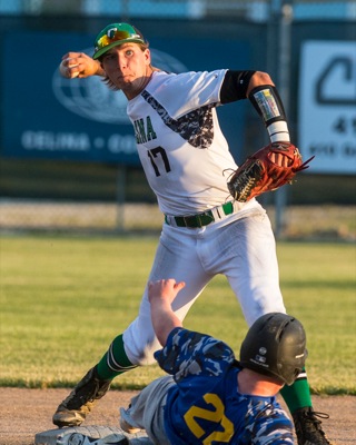
Chris O'Neill isn't too surprised that Grand Lake is out to a 9-4 start to the Great Lakes Summer Collegiate League baseball season.
As the first-year Mariners coach prepared his team, he had a feeling that this team would be ultra-competitive. [More]
Obituaries on June 21st, 2016
Stanferd R. Eshleman age 87 of Minster died at 3:00 PM on Saturday, June 18, 2016 at Joint Township District Memorial Hospital, St. Marys. [More]
Mary Ann Klingshirn, age 77, of Burkettsville, Ohio, died on June 20, 2016 in Greenville. [More]
Luella "Tude" (Romie) McGowan, age 92, Fort Loramie, passed away of natural cau [More]
Wayne Eugene Shellabarger, 88, of Mendon, passed away Monday, June 20, 2016, at St. Rita's Hospice in Lima. [More]
Local pictures on June 21st, 2016
Subscriber stories on June 21st, 2016
Voters expected to decide issues in November election
MINSTER - School board members plan to seek renewal of two tax levies on the November ballot.
Board members at Monday night's meeting approved a resolution to seek certification of alternative tax rates for a renewal 1 percent income tax, which is set to expire at the end of the year.

Two tax issues pay for town operations and street repair
FORT RECOVERY - Council members are moving forward with renewing two levies set to expire at the end of 2017.
Council members on Monday passed reso
Mercer County maintained the lowest unemployment rate in the state in May.
Mercer County's May unemployment rate was 2.9 percent, down from 3.0 per
MARIA STEIN - The 29th annual Country Fest kicks off Friday and continues through Sunday.
Country Fest will feature a variety of entertainment, inc
Murlin's two-hitter, clutch hitting key for Celina in 4-1 win
CELINA - Celina ACME baseball coach Scott Montgomery expects Tanner Freeman and Seth Lonsway to be clutch.
"Those are two of the guys we can count
Razz-Eye View
Cory Luebke beat the odds once to come back and pitch in the majors after two Tommy John surgeries.
Now he has to battle to return after having been designated for assignment on Saturday by the Pittsburgh Pirates.
Deadline to submit potential candidates' names is Aug. 1
Nominations are being accepted until Aug. 1 for one open seat on each Farm Service Agency committee in Mercer and Auglaize counties.
Each committee includes three members who each serve a three-year term.