Flood Watch issued August 14 at 9:48PM EDT until August 16 at 8:00AM EDT by NWS Wilmington OH (details ...)
* WHAT...Flash flooding caused by excessive rainfall continues to be possible.
* WHERE...Portions of Indiana, including the following counties, Fayette, Franklin, Union and Wayne and Ohio, including the following counties, Auglaize, Butler, Champaign, Clark, Clinton, Darke, Delaware, Fairfield, Fayette, Franklin, Greene, Hardin, Hocking, Licking, Logan, Madison, Mercer, Miami, Montgomery, Pickaway, Preble, Ross, Shelby, Union and Warren.
* WHEN...From Saturday afternoon through Sunday morning.
* IMPACTS...Excessive runoff may result in flooding of rivers, creeks, streams, and other low-lying and flood-prone locations.
* ADDITIONAL DETAILS... - Another round of showers and thunderstorms is expected to move through the region Saturday into Saturday night. Additional heavy rainfall may result in flash flooding.
67° 67° Sat 84° Sat 84° slight chance likely 72° 72° likely Sun 86° Sun 86° chance
Saturday, December 8th, 2018
Photo by Dan Melograna/The Daily Standard

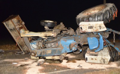
An overturned tractor blocks Fleetfoot Road Friday night after being struck from behind by an SUV carrying five Coldwater High School students.

Related online story:

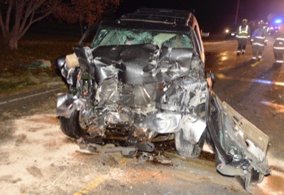
BUTLER TOWNSHIP - Six people were injured when an SUV carrying Coldwater High School swim team members struck the back of a tractor on Fleetfoot Road at about 7:30 p.m. Friday. [More]
Additional pictures on this date