Air Quality Alert issued July 16 at 12:23AM EDT by NWS Wilmington OH (details ...)
The Ohio Environmental Protection Agency has issued an Air Quality Advisory for the entire state of Ohio, through midnight EDT tonight. Smoke from Canadian wildfires will adversely impact air quality. The Agency expects the Air Quality Index to be in the 'unhealthy for sensitive groups' range. For additional actions and information, please visit the Ohio Environmental Protection Agency's web site at epa.ohio.gov.
Air Quality Alert issued July 16 at 12:16AM EDT by NWS Wilmington OH (details ...)
The Ohio Environmental Protection Agency has issued an Air Quality Advisory for the entire state of Ohio, from 7 AM Thursday to midnight EDT tonight. Smoke from Canadian wildfires will adversely impact air quality. The Agency expects the Air Quality Index to be in the 'unhealthy for sensitive groups' range. For additional actions and information, please visit the Ohio Environmental Protection Agency's web site at epa.ohio.gov.
Air Quality Alert issued July 15 at 9:35PM EDT by NWS Wilmington OH (details ...)
The Ohio Environmental Protection Agency has issued an Air Quality Advisory for the entire state of Ohio, from 7 AM Thursday to midnight EDT Thursday night. Smoke from Canadian wildfires will adversely impact air quality. The Agency expects the Air Quality Index to be in the 'unhealthy for sensitive groups' range. For additional actions and information, please visit the Ohio Environmental Protection Agency's web site at epa.ohio.gov.
Thursday, May 2nd, 2019
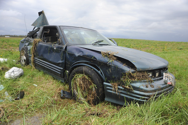
Mendon-area accident
Photo by Dan Melograna/The Daily Standard
A car traveling on State Route 707 west of Mendon hydroplaned, struck a utility pole and landed in a farm field on Wednesday afternoon, according to a Mercer County Sheriff's deputy at the scene. The driver was transported to a hospital with injuries.