Flood Watch issued August 19 at 7:53PM EDT until August 20 at 10:00AM EDT by NWS Wilmington OH (details ...)
* WHAT...Flash flooding caused by excessive rainfall continues to be possible. * WHERE...Portions of east central Indiana, including the following counties, Fayette, Union and Wayne and Ohio, including the following counties, Auglaize, Champaign, Clark, Darke, Delaware, Fairfield, Fayette, Franklin, Greene, Hardin, Hocking, Licking, Logan, Madison, Mercer, Miami, Montgomery, Pickaway, Preble, Shelby and Union. * WHEN...Through Thursday morning. * IMPACTS...Excessive runoff may result in flooding of rivers, creeks, streams, and other low-lying and flood-prone locations. * ADDITIONAL DETAILS... - Repeated rounds of storms, combined with the extremely wet soil conditions will increase the risk for flash flooding into the overnight hours.
Flood Warning issued August 19 at 8:49PM EDT until August 19 at 11:45PM EDT by NWS Wilmington OH (details ...)
* WHAT...Flooding caused by excessive rainfall is expected. * WHERE...Southeastern Auglaize County in west central Ohio... Southern Logan County in west central Ohio... Central Shelby County in west central Ohio... * WHEN...Until 1145 PM EDT. * IMPACTS...Flooding of rivers, creeks, streams, and other low-lying and flood-prone locations is imminent or occurring. * ADDITIONAL DETAILS... - At 848 PM EDT, local law enforcement and emergency management reported flooding in the warned area. Between 3 and 6 inches of rain have fallen. Additional rainfall amounts up to 0.5 inches are possible. - Some locations that may experience flooding include... Sidney, Bellefontaine, Newport, West Liberty, Anna, Fort Loramie, De Graff, Quincy, Port Jefferson, Valley Hi, Zanesfield, Maplewood, Pemberton, Logansville, Mcmorran, Swanders, Pickrelltown, New Jerusalem and Lake Loramie State Park.
Flood Advisory issued August 19 at 6:33PM EDT until August 19 at 10:30PM EDT by NWS Wilmington OH (details ...)
* WHAT...Flooding caused by excessive rainfall continues. * WHERE...Southern Auglaize County in west central Ohio... Northwestern Logan County in west central Ohio... Northern Shelby County in west central Ohio... * WHEN...Until 1030 PM EDT. * IMPACTS...Minor flooding in low-lying and poor drainage areas. Water over roadways. * ADDITIONAL DETAILS... - At 633 PM EDT, radar and automated rain gauges indicated heavy rain due to thunderstorms. Minor flooding is ongoing or expected to begin shortly in the advisory area. Between 1 and 2 inches of rain have fallen. Additional rainfall amounts of 0.5 to 1 inch are possible. - Some locations that may experience flooding include... New Bremen, Minster, Jackson Center, Russells Point, Botkins, Lakeview, Huntsville, Kettlersville, Montra, Mccartyville, Lewistown and Egypt.
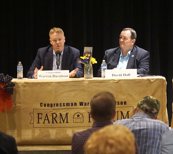
PIQUA - U.S. Rep. Warren Davidson, R-Troy, is confident the federal government has the resources and capability to handle the coronavirus COVID-19, saying the media coverage of the outbreak has been somewhat hyped.
Davidson addressed the virus at Saturday's 2020 Farm Forum held at Edison State Community College in Piqua, where he also laid out his top agriculture-based legislative priorities to an audience of farmers and agriculture advocates. [More]
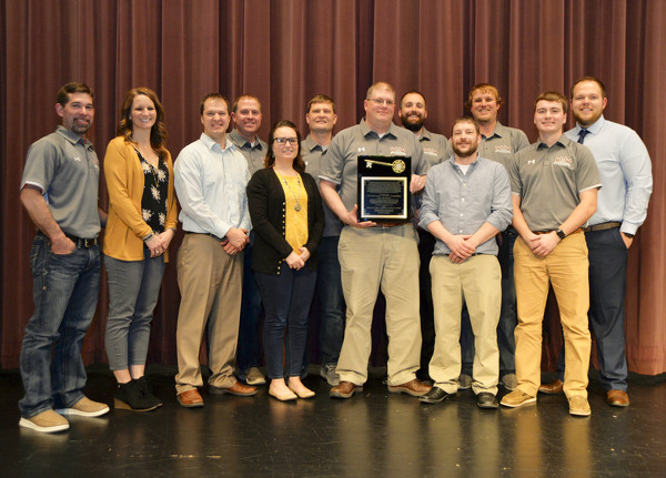
FORT RECOVERY - Several community members were honored Sunday evening during the Fort Recovery Chamber of Commerce's annual awards banquet.
Greg Lefevre was awarded the 2019 citizen of the year award. Lefevre graduated from Fort Recovery High School in 1990 and was Valedictorian of his class.
Division IV Girls Basketball Regional Championship
Brothers Trevor and Tyler Hisey will represent St. Marys at the Division II state wrestling tournament this week after both qualified at the district tournament that concluded Saturday in Norwalk.
The West Ohio High School Bowling Conference handed out postseason honors for both the WOHSBC and the Midwest Athletic Conference on Sunday at Romer's Catering in St. Henry.