Special Weather Statement issued May 1 at 12:13PM EDT by NWS Wilmington OH (details ...)
At 1212 PM EDT, a strong thunderstorm was located near New Bremen, moving northeast at 50 mph.
HAZARD...Wind gusts up to 45 mph and pea size hail.
SOURCE...Radar indicated.
IMPACT...Gusty winds could knock down tree limbs and blow around unsecured objects. Hail may cause minor damage to vegetation.
Locations impacted include... Newport, Fryburg, Montra, Egypt, Uniopolis, New Bremen, Buckland, Botkins, New Knoxville, Fort Loramie, Kettlersville, Moulton, Jackson Center, St. Marys, Anna, Kossuth, Lakeview, Lake Loramie State Park, Waynesfield, and Wapakoneta.
This includes I-75 in Ohio between mile markers 96 and 118.
If outdoors, consider seeking shelter inside a sturdy building.
To report hazardous weather conditions, go to our website at weather.gov/iln and submit your report via social media, when you can do so safely.
Today 74° Today 74° 58° 58° chance Tomorrow 71° Tomorrow 71° chance 54° 54° chance
Wednesday, February 3rd, 2021
Photo by Ryan Snyder/The Daily Standard

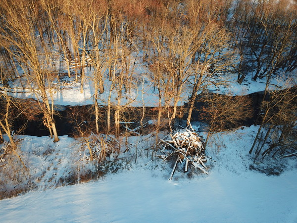
Logs that have been plucked from the St. Marys River are heaped in piles along the bank near where the waterway crosses State Route 116 in northwestern Auglaize County.

Related online story:
WAPAKONETA - Officials may increase assessments for properties in the St. Marys River floodplain to raise money for logjam removal.
Auglaize County [More]
Additional pictures on this date