Tornado Warning issued March 26 at 8:07PM EDT until March 26 at 8:45PM EDT by NWS Wilmington OH (details ...)
TORILN The National Weather Service in Wilmington has issued a * Tornado Warning for... Northwestern Shelby County in west central Ohio... Northeastern Darke County in west central Ohio... Southwestern Auglaize County in west central Ohio... Southern Mercer County in west central Ohio... * Until 845 PM EDT. * At 807 PM EDT, a severe thunderstorm capable of producing a tornado was located near St. Henry, moving east at 40 mph. HAZARD...Tornado and golf ball size hail. SOURCE...Radar indicated rotation. IMPACT...Flying debris will be dangerous to those caught without shelter. Mobile homes will be damaged or destroyed. Damage to roofs, windows, and vehicles will occur. Tree damage is likely. * Locations impacted include... Coldwater, New Bremen, Minster, St. Henry, Newport, Fort Loramie, Fort Recovery, Wabash, Russia, Osgood, Chickasaw, Burkettsville, North Star, Kettlersville, Montezuma, New Weston, Yorkshire, Egypt, Lake Loramie State Park, and Maria Stein.
Severe Thunderstorm Warning issued March 26 at 7:44PM EDT until March 26 at 8:30PM EDT by NWS Wilmington OH (details ...)
SVRILN The National Weather Service in Wilmington has issued a * Severe Thunderstorm Warning for... Northwestern Shelby County in west central Ohio... Northern Darke County in west central Ohio... Southwestern Auglaize County in west central Ohio... Mercer County in west central Ohio... * Until 830 PM EDT. * At 743 PM EDT, a severe thunderstorm was located near Geneva, moving east at 55 mph. HAZARD...Ping pong ball size hail and 60 mph wind gusts. SOURCE...Radar indicated. IMPACT...People and animals outdoors will be injured. Expect hail damage to roofs, siding, windows, and vehicles. Expect wind damage to trees and power lines. * Locations impacted include... Celina, St. Marys, Coldwater, New Bremen, Minster, Versailles, St. Henry, Newport, Fort Loramie, Fort Recovery, Ansonia, New Knoxville, Webster, Wabash, Russia, Osgood, Chickasaw, Burkettsville, North Star, and Rossburg.
Tornado Watch issued March 26 at 7:37PM EDT until March 26 at 11:00PM EDT by NWS Wilmington OH (details ...)
TORNADO WATCH 75 REMAINS VALID UNTIL 11 PM EDT THIS EVENING FOR THE FOLLOWING AREAS IN OHIO THIS WATCH INCLUDES 8 COUNTIES IN CENTRAL OHIO DELAWARE LICKING UNION OH IN WEST CENTRAL OHIO AUGLAIZE HARDIN LOGAN MERCER SHELBY THIS INCLUDES THE CITIES OF ADA, BELLEFONTAINE, CELINA, COLDWATER, DELAWARE, KENTON, MARYSVILLE, NEWARK, SIDNEY, ST. MARYS, AND WAPAKONETA.
No injuries reported requiring emergency medical transport
By Daily Standard Staff
By WILLIAM KINCAID
and SYDNEY ALBERT
newsdept@dailystandard.com
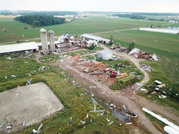
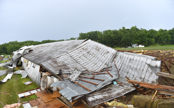
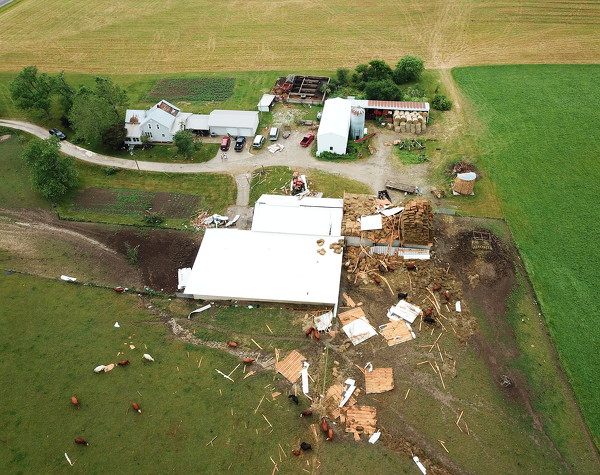
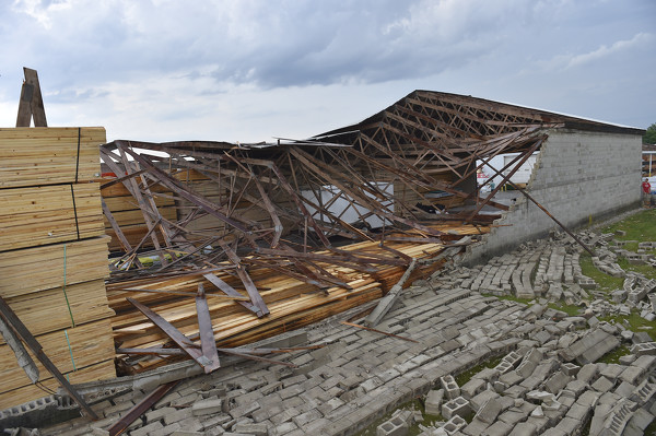
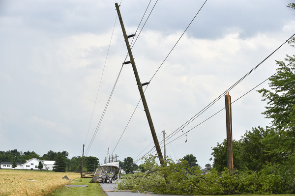
FORT RECOVERY - A tornado touched down on a stretch of Fort Recovery-Minster Road on Friday, wreaking havoc on homes and structures, tearing off roofs, toppling trees and utility poles and causing power outages that stretched up to Coldwater. [More]