Heat Advisory issued June 26 at 3:14PM EDT until June 27 at 8:00PM EDT by NWS Wilmington OH (details ...)
* WHAT...Heat index values in the upper 90s to lower 100s.
* WHERE...Portions of east central and southeast Indiana, northeast and northern Kentucky, and central, south central, southwest, and west central Ohio.
* WHEN...Until 8 PM EDT Friday.
* IMPACTS...Hot temperatures and high humidity may cause heat illnesses.
* ADDITIONAL DETAILS...Consecutive days of high heat and humidity can be especially hazardous as warm overnight temperatures will provide little relief.
Flood Advisory issued June 26 at 5:42PM EDT until June 26 at 8:45PM EDT by NWS Wilmington OH (details ...)
* WHAT...Flooding caused by excessive rainfall is expected.
* WHERE...The following county, in west central Ohio, Auglaize.
* WHEN...Until 845 PM EDT.
* IMPACTS...Minor flooding in low-lying and poor drainage areas.
* ADDITIONAL DETAILS... - At 542 PM EDT, radar indicated heavy rain due to thunderstorms. Minor flooding is ongoing or expected to begin shortly in the advisory area. Between 1 and 2 inches of rain have fallen. Additional rainfall amounts of 0.5 to 1 inch are possible. - Some locations that may experience flooding include... Wapakoneta, Fort Shawnee, Cridersville, Waynesfield, Uniopolis, St. Johns, Fryburg and New Hampshire.
Today 90° Today 90° chance 75° 75° chance Tomorrow 90° Tomorrow 90° likely 73° 73° likely chance
Monday, October 4th, 2021
Photo by Dan Melograna/The Daily Standard

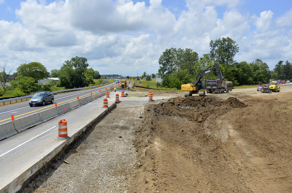
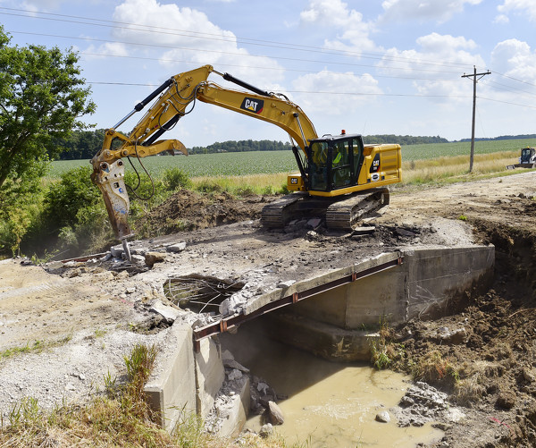
Crews work at U.S. 33 and Wapakoneta-Fisher Road in Auglaize County to fix the county's most dangerous intersection.

Related online story:
CELINA - On a hot June day on the Wabash River, Mercer County engineer Jim Wiechart discussed one of the favorite parts of his job: bridge inspection. [More]
Additional pictures on this date