Special Weather Statement issued August 9 at 8:12PM EDT by NWS Wilmington OH (details ...)
At 811 PM EDT, strong thunderstorms were located along a line extending from near Elida to near Celina to near Hartford City, moving southeast at 25 mph. HAZARD...Wind gusts up to 50 mph. SOURCE...Radar indicated. IMPACT...Gusty winds could knock down tree limbs and blow around unsecured objects. Locations impacted include... Celina, Wapakoneta, St. Marys, Ada, Coldwater, New Bremen, Minster, St. Henry, Cridersville, Union City, Anna, Fort Loramie, Jackson Center, Fort Recovery, Botkins, Lakeview, New Knoxville, Dunkirk, Alger, and Waynesfield. This includes I-75 in Ohio between mile markers 100 and 117. If outdoors, consider seeking shelter inside a sturdy building. A Severe Thunderstorm Watch remains in effect until midnight EDT for west central Ohio. To report hazardous weather conditions, go to our website at weather.gov/iln and submit your report via social media, when you can do so safely.
Severe Thunderstorm Watch issued August 9 at 7:22PM EDT until August 10 at 12:00AM EDT by NWS Wilmington OH (details ...)
THE NATIONAL WEATHER SERVICE HAS ISSUED SEVERE THUNDERSTORM WATCH 548 IN EFFECT UNTIL MIDNIGHT EDT TONIGHT FOR THE FOLLOWING AREAS IN OHIO THIS WATCH INCLUDES 8 COUNTIES IN CENTRAL OHIO DELAWARE LICKING UNION IN WEST CENTRAL OHIO AUGLAIZE HARDIN LOGAN MERCER SHELBY THIS INCLUDES THE CITIES OF ADA, BELLEFONTAINE, CELINA, COLDWATER, DELAWARE, KENTON, MARYSVILLE, MINSTER, NEW BREMEN, NEWARK, SIDNEY, ST. MARYS, AND WAPAKONETA.
Special Weather Statement issued August 9 at 8:37PM EDT by NWS Wilmington OH (details ...)
At 837 PM EDT, strong thunderstorms were located along a line extending from near Arlington to near Lakeview to near Fort Loramie, moving southeast at 55 mph. HAZARD...Wind gusts up to 40 mph. SOURCE...Radar indicated. IMPACT...Gusty winds could knock down tree limbs and blow around unsecured objects. Locations impacted include... Marysville, Sidney, Bellefontaine, Kenton, Richwood, Newport, West Liberty, Anna, North Lewisburg, Fort Loramie, Jackson Center, Forest, Russells Point, De Graff, Lakeview, Dunkirk, Belle Center, West Mansfield, Chippewa Park, and Hardin. This includes I-75 in Ohio between mile markers 89 and 101. If outdoors, consider seeking shelter inside a sturdy building. A Severe Thunderstorm Watch remains in effect until midnight EDT for central and west central Ohio. To report hazardous weather conditions, go to our website at weather.gov/iln and submit your report via social media, when you can do so safely.
CELINA - A mediator will be brought in to help jumpstart contract negotiations between administrators and teachers at Celina City Schools, superintendent Ken Schmiesing said after Monday's regular school board meeting.
LAKE PLACID, Fla. - As a successful obstetrics and gynecology practitioner in Newark, Celina native Dr. Nick Reed delivered more than 12,000 babies during his 44-year career. [More]
FORT RECOVERY -The village may receive more grant funding than anticipated in connection with a multi-use trail project, village councilors learned at Monday night's regular meeting.
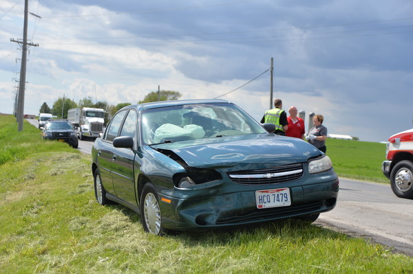
CARTHAGENA - Two people suffered minor injuries in a three-vehicle chain-reaction accident reported at 3:26 p.m. Monday at the intersection of Carthagena Road and U.S. 127, according to Mercer County Sheriff's Deputy Kirsten Nixon.
FORT RECOVERY - Fort Recovery school board members during their Monday meeting awarded a $55,299 contract to Regal Plumbing and Heating Co., Sidney, to install a new chiller for the district.
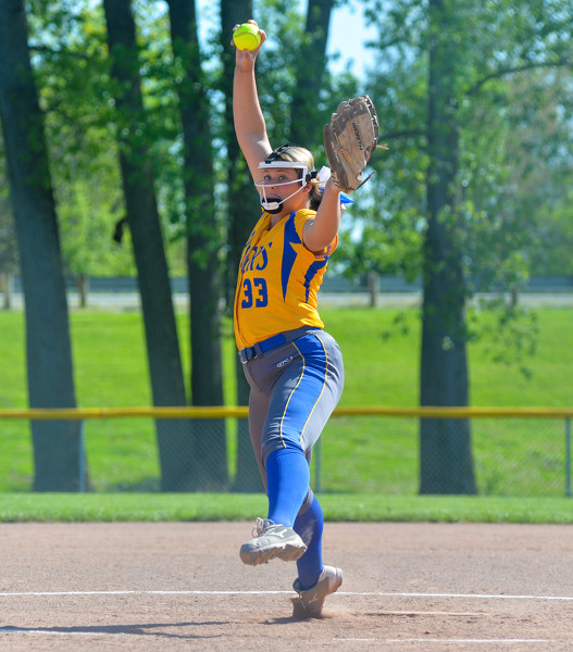
St. Marys senior Karsyn McGlothen and Wapakoneta junior Allie Wilson were named the Western Buckeye League co-Softball Players of the Year by the league coaches as the WBL released its softball and baseball honors on Monday. [More]