Extreme Heat Warning issued July 3 at 11:21AM EDT until July 3 at 8:00PM EDT by NWS Wilmington OH (details ...)
* WHAT...For the Extreme Heat Warning, dangerously hot conditions with heat index values around 105 are expected. For the Heat Advisory, heat index values around 100 are expected. * WHERE...Portions of east central and southeast Indiana, northeast and northern Kentucky, and central, south central, southwest, and west central Ohio. * WHEN...For the Extreme Heat Warning, until 8 PM EDT this evening. For the Heat Advisory, from 8 PM this evening to 8 PM EDT Saturday. * IMPACTS...Heat related illnesses increase significantly during extreme heat and high humidity events, particularly for those working or participating in outdoor activities. Hot temperatures and high humidity may cause heat illnesses. * ADDITIONAL DETAILS...Remember, multiple days with excessive heat can have compounding effects.
Heat Advisory issued July 3 at 11:21AM EDT until July 4 at 8:00PM EDT by NWS Wilmington OH (details ...)
* WHAT...For the Extreme Heat Warning, dangerously hot conditions with heat index values around 105 are expected. For the Heat Advisory, heat index values around 100 are expected. * WHERE...Portions of east central and southeast Indiana, northeast and northern Kentucky, and central, south central, southwest, and west central Ohio. * WHEN...For the Extreme Heat Warning, until 8 PM EDT this evening. For the Heat Advisory, from 8 PM this evening to 8 PM EDT Saturday. * IMPACTS...Heat related illnesses increase significantly during extreme heat and high humidity events, particularly for those working or participating in outdoor activities. Hot temperatures and high humidity may cause heat illnesses. * ADDITIONAL DETAILS...Remember, multiple days with excessive heat can have compounding effects.
Special Weather Statement issued July 3 at 7:22PM EDT by NWS Wilmington OH (details ...)
At 722 PM EDT, a strong thunderstorm was located near Wapakoneta, moving east at 45 mph. HAZARD...Wind gusts up to 40 mph. SOURCE...Radar indicated. IMPACT...Gusty winds could knock down tree limbs and blow around unsecured objects. Locations impacted include... Wapakoneta, St. Marys, Fort Shawnee, Cridersville, New Knoxville, Waynesfield, Moulton, Buckland, Uniopolis, Fryburg, Kossuth, St. Johns, and New Hampshire. This includes I-75 in Ohio between mile markers 107 and 118. If outdoors, consider seeking shelter inside a sturdy building. To report hazardous weather conditions, go to our website at weather.gov/iln and submit your report via social media, when you can do so safely.
Fans up late for copies of popular Zelda video game
CELINA - Nearly two dozen fans of "The Legend of Zelda" video game series descended on Gamestop on Thursday night for the highly anticipated midni [More]
CELINA - An auction house in the city industrial park will be shut down today for failing to secure a conditional use permit from the Celina Planning Commission.
CELINA - Mercer Soil and Water Conservation District Board of Supervisors on Thursday morning approved entering into a $40,000 grant agreement with the Ohio Environmental Protection Agency.
Ross throws shutout, bats pull away from USV in sixth
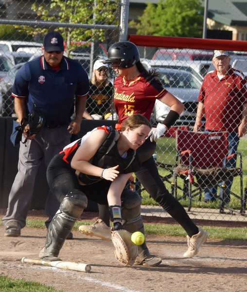
NEW BREMEN - A two-run error in the first inning got New Bremen started, and the Cardinals piled on big hits in the sixth to put away a sectional final win. [More]
MINSTER - A record-breaking home run capped Minster's 10-0 sectional final victory over Lima Central Catholic Thursday afternoon at Four Seasons Park in Minster.
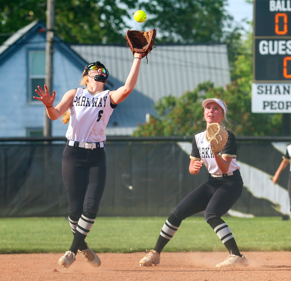
ROCKFORD - Parkway wasted no time getting the lead and coach Trey Stover played his entire roster in opening Division IV sectional softball play with an 18-1 win over Hardin Northern on Thursday in Rockford.
St. Henry opened the Division IV softball tournament with a bang, scoring 10 runs in the first inning on the way to a 17-0, five-inning win at Ada in the sectional final on Thursday.