The Daily Standard
Pictures Archive
Menu
▼
Home
Subscribe
E-Edition
Archives
▼
Archives
Obituary Archives
Photo Albums
Podcasts
▼
Podcasts
Video
Classifieds
▼
Classifieds
Public Notices
Weather
Sports
More
▼
Contacts
Advertising
Subscription Payment
Community Pictures
Historical Maps
Forms
Locations
Elections
Today
70°
Today
70°
43°
43°
Tomorrow
68°
Tomorrow
68°
43°
43°
Saturday, February 10th, 2024
Photo by Daily Standard Staff
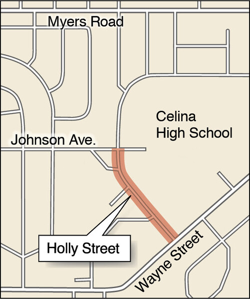
Map showing the proposed street closure for the Celina City Schools building project.
Related online story:
Members seek permanent street closure
CELINA - School board members at this week's special meeting signed off on a petition asking Celina City Council to permanently close a portion of Holly Street so they can proceed with the construction of a new 7-12 grade building. [
More
]
Purchase a print of this photo.
Archive of February 10th, 2024
Buy this E-Edition
Additional pictures on this date
<!--Unsupported browser-->
Copyright © 2026 Standard Printing Co. All Rights Reserved