Extreme Heat Warning issued July 3 at 11:21AM EDT until July 3 at 8:00PM EDT by NWS Wilmington OH (details ...)
* WHAT...For the Extreme Heat Warning, dangerously hot conditions with heat index values around 105 are expected. For the Heat Advisory, heat index values around 100 are expected.
* WHERE...Portions of east central and southeast Indiana, northeast and northern Kentucky, and central, south central, southwest, and west central Ohio.
* WHEN...For the Extreme Heat Warning, until 8 PM EDT this evening. For the Heat Advisory, from 8 PM this evening to 8 PM EDT Saturday.
* IMPACTS...Heat related illnesses increase significantly during extreme heat and high humidity events, particularly for those working or participating in outdoor activities. Hot temperatures and high humidity may cause heat illnesses.
* ADDITIONAL DETAILS...Remember, multiple days with excessive heat can have compounding effects.
Heat Advisory issued July 3 at 11:21AM EDT until July 4 at 8:00PM EDT by NWS Wilmington OH (details ...)
* WHAT...For the Extreme Heat Warning, dangerously hot conditions with heat index values around 105 are expected. For the Heat Advisory, heat index values around 100 are expected.
* WHERE...Portions of east central and southeast Indiana, northeast and northern Kentucky, and central, south central, southwest, and west central Ohio.
* WHEN...For the Extreme Heat Warning, until 8 PM EDT this evening. For the Heat Advisory, from 8 PM this evening to 8 PM EDT Saturday.
* IMPACTS...Heat related illnesses increase significantly during extreme heat and high humidity events, particularly for those working or participating in outdoor activities. Hot temperatures and high humidity may cause heat illnesses.
* ADDITIONAL DETAILS...Remember, multiple days with excessive heat can have compounding effects.
Special Weather Statement issued July 3 at 7:22PM EDT by NWS Wilmington OH (details ...)
At 722 PM EDT, a strong thunderstorm was located near Wapakoneta, moving east at 45 mph.
HAZARD...Wind gusts up to 40 mph.
SOURCE...Radar indicated.
IMPACT...Gusty winds could knock down tree limbs and blow around unsecured objects.
Locations impacted include... Wapakoneta, St. Marys, Fort Shawnee, Cridersville, New Knoxville, Waynesfield, Moulton, Buckland, Uniopolis, Fryburg, Kossuth, St. Johns, and New Hampshire.
This includes I-75 in Ohio between mile markers 107 and 118.
If outdoors, consider seeking shelter inside a sturdy building.
To report hazardous weather conditions, go to our website at weather.gov/iln and submit your report via social media, when you can do so safely.
Today 93° Today 93° slight chance 75° 75° chance Tomorrow 90° Tomorrow 90° slight chance 72° 72° chance likely
Wednesday, February 14th, 2024
Photo by Paige Sutter/The Daily Standard

Celina's Aaren King prepares to pin Wapakoneta's Elijah Burgoon in their 126-pound bout during Tuesday's wrestling matches.

Related online story:
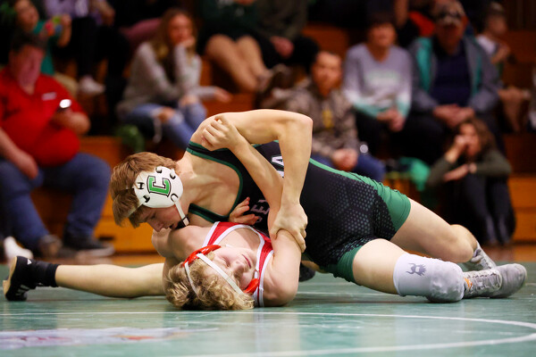
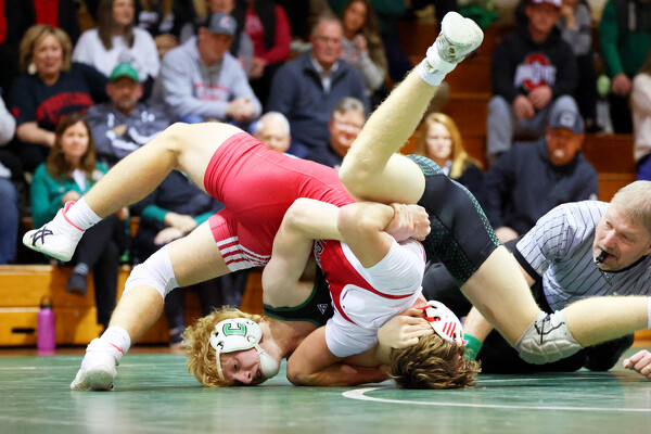
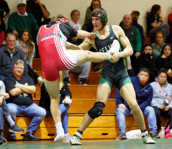
CELINA - Wapakoneta showed it is the team to beat in Western Buckeye League wrestling.  
The Redskins held Celina to just three competitive wins on the night to complete an undefeated league record with a 48-27 victory on Tuesday night at Celina High School. [More]
Additional pictures on this date