Freeze Warning issued April 7 at 2:33AM EDT until April 7 at 10:00AM EDT by NWS Wilmington OH (details ...)
* WHAT...Sub-freezing temperatures as low as 27. * WHERE...Portions of east central and southeast Indiana, northeast and northern Kentucky, and central, south central, southwest, and west central Ohio. * WHEN...Until 10 AM EDT this morning. * IMPACTS...Frost and freeze conditions could kill crops, other sensitive vegetation and possibly damage unprotected outdoor plumbing.
Saturday, June 1st, 2024
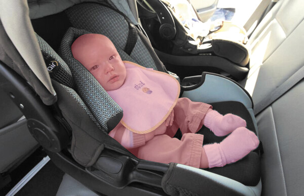
Photo by Daily Standard Staff
Even with the windows cracked the temperature inside a car can reach 125 degrees in minutes.
CELINA - As temperatures quickly rise, so too do concerns about children and pets being left alone in locked cars, putting them at risk for heat exhaustion and even death. [More]