The Daily Standard
World News

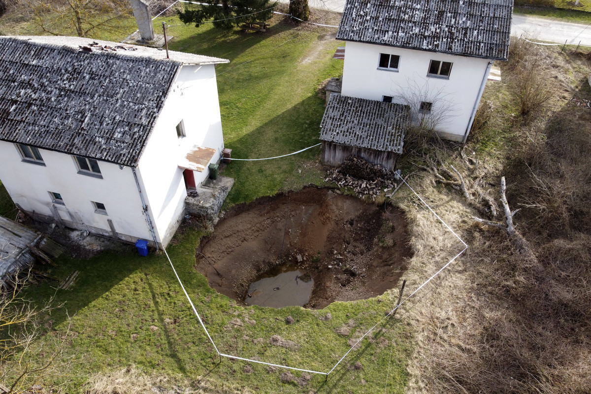
This aerial photo shows a sinkhole in the village of Mececani, central Croatia, Thursday, March 4, 2021. A central Croatian region about 40 kilometers (25 miles) southwest of the capital Zagreb is pocked with round holes of all sizes, which appeared after December's 6.4-magnitude quake that killed seven people and caused widespread destruction. Scientists have been flocking to Mecencani and other villages in the sparsely-inhabited region for observation and study. (AP Photo/Darko Bandic)
MECENCANI, Croatia (AP) - After the deadly earthquake came the sinkholes.
A central Croatian region about 40 kilometers (25 miles) southwest of the capital, Zagreb, is pocked with round holes of all sizes, which appeared after December's 6.4-magnitude quake that killed seven people and caused widespread destruction.
Scientists have been flocking to Mecencani and other villages in the sparsely-inhabited region for observation and study.
"These are so-called dropout sinkholes, and they appeared because of the specific geological composition of this area, as the soil rests on limestone rocks heavily saturated with groundwater," said geologist Josip Terzic of the Croatian Geological Survey.
This aerial photo shows a sinkhole in the village of Mececani, central Croatia, Thursday, March 4, 2021. A central Croatian region about 40 kilometers (25 miles) southwest of the capital Zagreb is pocked with round holes of all sizes, which appeared after December's 6.4-magnitude quake that killed seven people and caused widespread destruction. Scientists have been flocking to Mecencani and other villages in the sparsely-inhabited region for observation and study. (AP Photo/Darko Bandic)
While the appearance of sinkholes is not unusual following strong seismic activity, residents have been baffled by their number - about 100 have been spotted over the past two months - and the speed at which they emerged after the main earthquake on Dec. 29, which was followed by a series of aftershocks. Geologists have said that the temblor accelerated the process of sinkhole formation that would normally have taken years, if not decades.
Terzic said scientists are planning various exploration methods to determine the underwater morphology and other characteristics. He spoke to The Associated Press as he stood beside a large sinkhole that he said was up to 15 meters (yards) deep and equally wide.
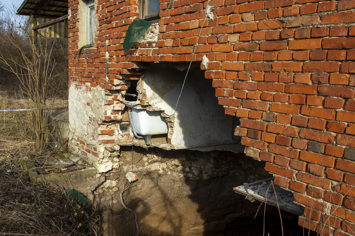
This photo shows a sinkhole under a house in the village of Mececani, central Croatia, Thursday, March 4, 2021. A central Croatian region about 40 kilometers (25 miles) southwest of the capital Zagreb is pocked with round holes of all sizes, which appeared after December's 6.4-magnitude quake that killed seven people and caused widespread destruction. Scientists have been flocking to Mecencani and other villages in the sparsely-inhabited region for observation and study. (AP Photo/Darko Bandic)
Some sinkholes have appeared by people's houses or on their farmland, prompting the authorities to advise caution. Nenad Tomasevic, a teacher from Mecencani, said it all seemed too much.
"The earthquake itself felt pretty unpleasant to say the least. And after that, these holes started popping up," said Tomasevic, who had to move to a neighbor's house after an expanding hole appeared in his backyard.
"Experts say that these sinkholes would have formed naturally anyway over time, but the earthquake acted as sort of a catalyst which sped up the whole process, unfortunately," he added.
Some three months after the earthquake, the hardest-hit area is still struggling with its devastation, with many houses still in rubble and the region's main town, Petrinja, semi-abandoned. Occasional earthquakes, including those of magnitude 4 or more, can still be felt, further upsetting residents and adding to the coronavirus pandemic woes.
This aerial photo shows a sinkhole in the village of Mececani, central Croatia, Thursday, March 4, 2021. A central Croatian region about 40 kilometers (25 miles) southwest of the capital Zagreb is pocked with round holes of all sizes, which appeared after December's 6.4-magnitude quake that killed seven people and caused widespread destruction. Scientists have been flocking to Mecencani and other villages in the sparsely-inhabited region for observation and study. (AP Photo/Darko Bandic)
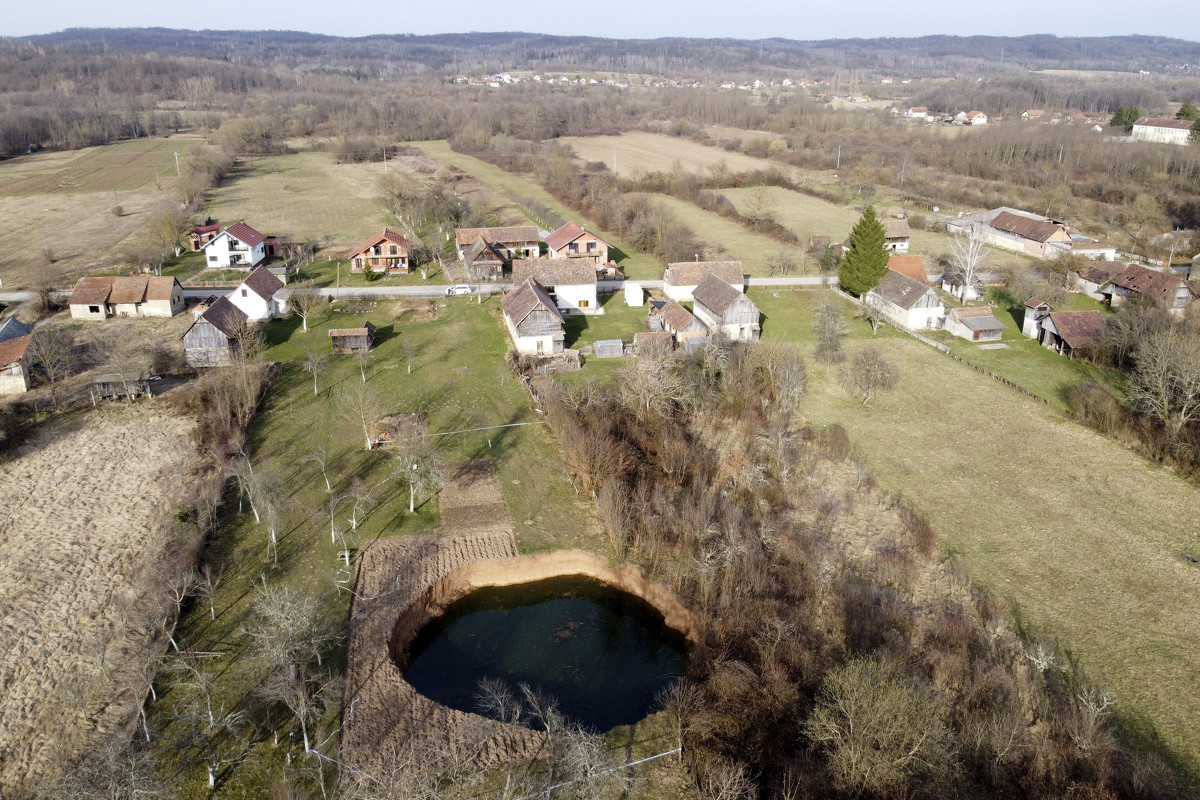
This aerial photo shows a sinkhole in the village of Mececani, central Croatia, Thursday, March 4, 2021. A central Croatian region about 40 kilometers (25 miles) southwest of the capital Zagreb is pocked with round holes of all sizes, which appeared after December's 6.4-magnitude quake that killed seven people and caused widespread destruction. Scientists have been flocking to Mecencani and other villages in the sparsely-inhabited region for observation and study. (AP Photo/Darko Bandic)
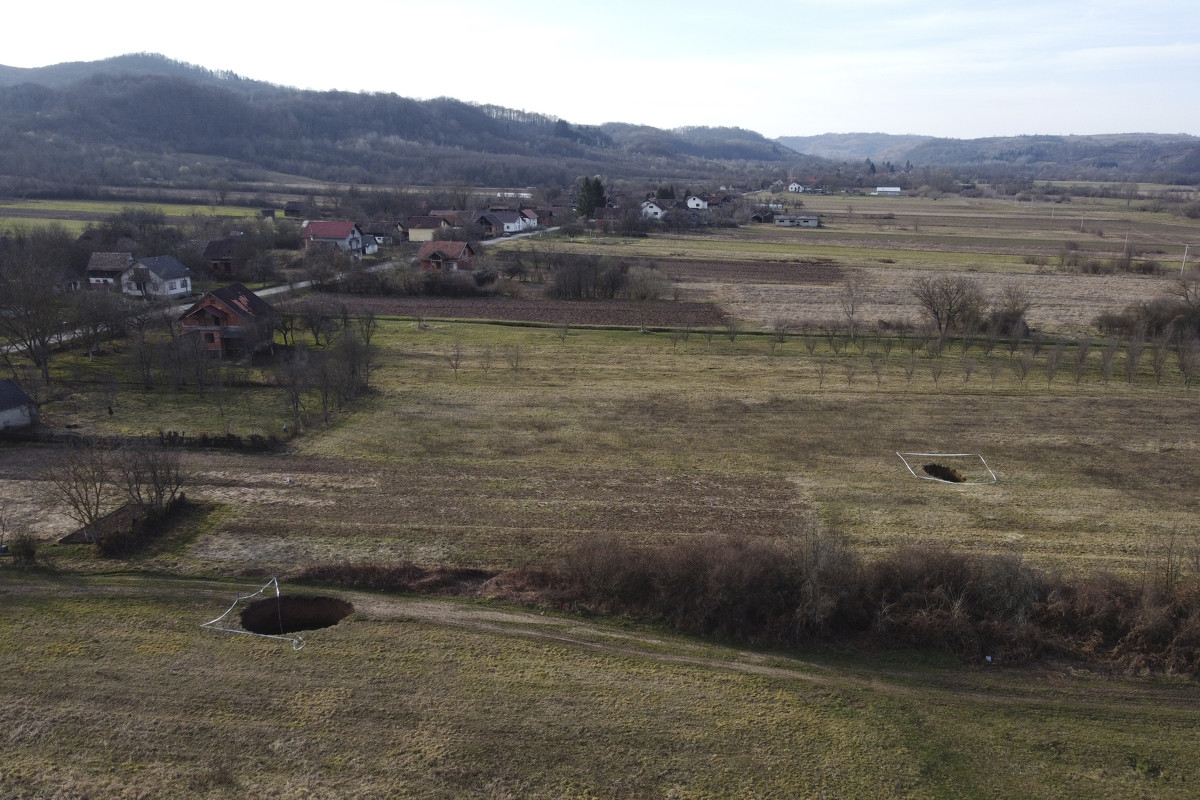
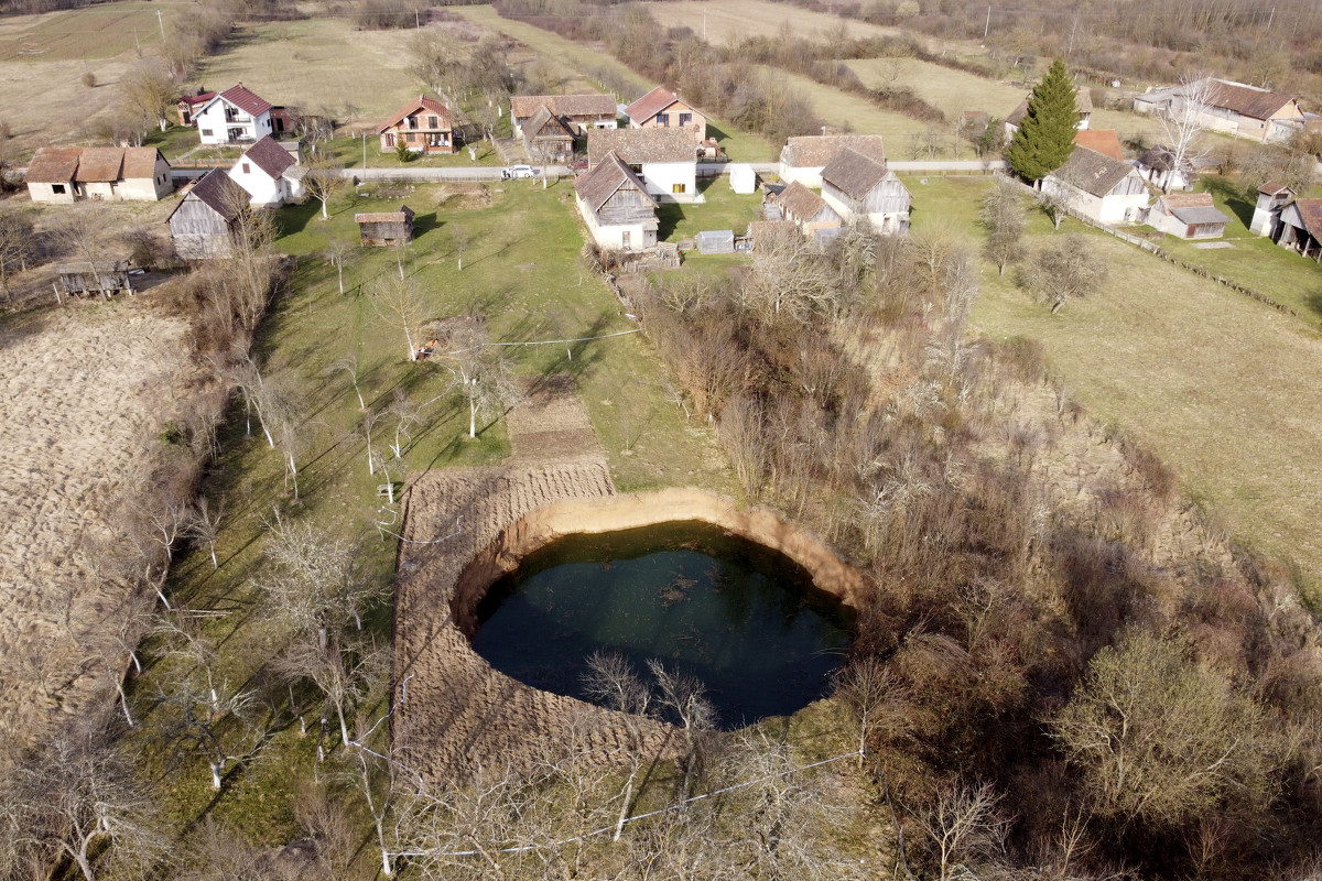
This aerial photo shows sinkholes in the village of Mececani, central Croatia, Thursday, March 4, 2021. A central Croatian region about 40 kilometers (25 miles) southwest of the capital Zagreb is pocked with round holes of all sizes, which appeared after December's 6.4-magnitude quake that killed seven people and caused widespread destruction. Scientists have been flocking to Mecencani and other villages in the sparsely-inhabited region for observation and study. (AP Photo/Darko Bandic)
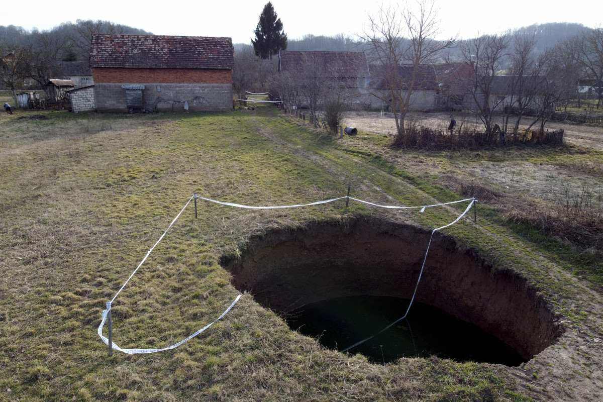
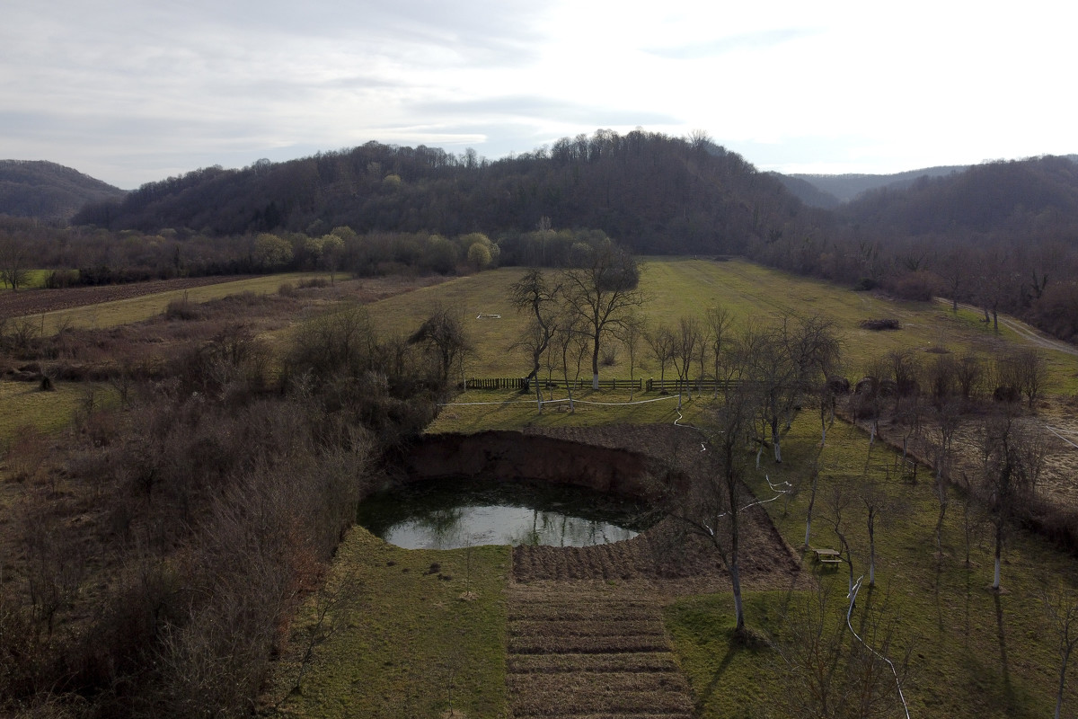
This aerial photo shows a sinkhole in the village of Mececani, central Croatia, Thursday, March 4, 2021. A central Croatian region about 40 kilometers (25 miles) southwest of the capital Zagreb is pocked with round holes of all sizes, which appeared after December's 6.4-magnitude quake that killed seven people and caused widespread destruction. Scientists have been flocking to Mecencani and other villages in the sparsely-inhabited region for observation and study. (AP Photo/Darko Bandic)
