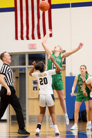
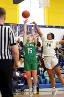
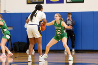
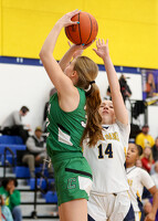
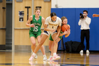
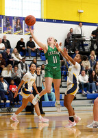
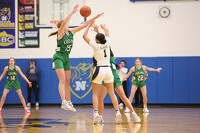
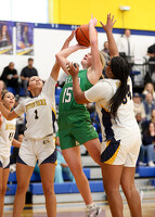
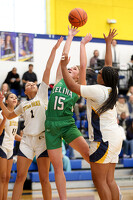
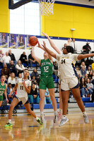
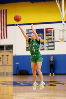
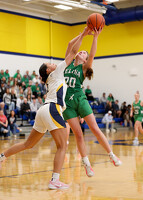
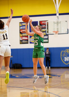
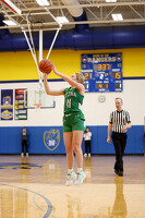
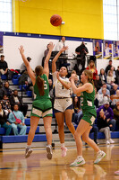
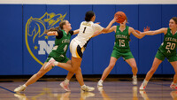
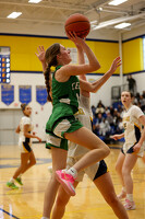
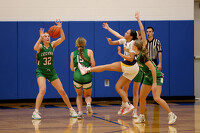
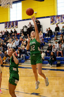
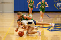
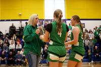
Celina vs Toledo Notre Dame Academy girls basketball
116 of 118 pictures
Saturday, February 28th
Photo by Paige Sutter/The Daily Standard
Special Weather Statement issued April 14 at 6:34PM EDT by NWS Wilmington OH (details ...)
At 633 PM EDT, a strong thunderstorm was located near Geneva, moving northeast at 35 mph.
HAZARD...Wind gusts up to 40 mph, penny size hail, and very heavy rain.
SOURCE...Radar indicated.
IMPACT...Gusty winds could knock down tree limbs and blow around unsecured objects. Hail may cause minor damage to vegetation. Visibility will be poor and hydroplaning is possible.
Locations impacted include... Celina, Coldwater, Rockford, Wabash, Chattanooga, and Tama.
If outdoors, consider seeking shelter inside a sturdy building.
Motorists should slow down and use extra caution.
A Severe Thunderstorm Watch remains in effect until 1100 PM EDT for west central Ohio.
To report hazardous weather conditions, go to our website at weather.gov/iln and submit your report via social media, when you can do so safely.
Severe Thunderstorm Watch issued April 14 at 5:16PM EDT until April 14 at 11:00PM EDT by NWS Wilmington OH (details ...)
THE NATIONAL WEATHER SERVICE HAS ISSUED SEVERE THUNDERSTORM WATCH 112 IN EFFECT UNTIL 11 PM EDT THIS EVENING FOR THE FOLLOWING AREAS
IN INDIANA THIS WATCH INCLUDES 4 COUNTIES
IN EAST CENTRAL INDIANA
FAYETTE UNION WAYNE
IN SOUTHEAST INDIANA
FRANKLIN
IN OHIO THIS WATCH INCLUDES 7 COUNTIES
IN WEST CENTRAL OHIO
AUGLAIZE DARKE MERCER MIAMI MONTGOMERY PREBLE SHELBY
THIS INCLUDES THE CITIES OF BROOKVILLE, CAMDEN, CELINA, COLDWATER, CONNERSVILLE, DOWNTOWN DAYTON, EATON, GREENVILLE, KETTERING, LIBERTY, MINSTER, NEW BREMEN, PIQUA, RICHMOND, SIDNEY, ST. MARYS, TIPP CITY, TROY, WAPAKONETA, AND WEST COLLEGE CORNER.
Today 82° Today 82° chance 67° 67° chance Tomorrow 83° Tomorrow 83° likely 66° 66° likely
thum pict
thum pict
thum pict
thum pict
thum pict
thum pict
thum pict
thum pict
thum pict
thum pict
thum pict
thum pict
thum pict
thum pict
thum pict
thum pict
thum pict
thum pict
thum pict
thum pict
thum pict
thum pict
thum pict
thum pict
thum pict
thum pict
thum pict
thum pict
thum pict
thum pict
thum pict
thum pict
thum pict
thum pict
thum pict
thum pict
thum pict
thum pict
thum pict
thum pict
thum pict
thum pict
thum pict
thum pict
thum pict
thum pict
thum pict
thum pict
thum pict
thum pict
thum pict
thum pict
thum pict
thum pict
thum pict
thum pict
thum pict
thum pict
thum pict
thum pict
thum pict
thum pict
thum pict
thum pict
thum pict
thum pict
thum pict
thum pict
thum pict
thum pict
thum pict
thum pict
thum pict
thum pict
thum pict
thum pict
thum pict
thum pict
thum pict
thum pict
thum pict
thum pict
thum pict
thum pict
thum pict
thum pict
thum pict
thum pict
thum pict
thum pict
thum pict
thum pict
thum pict
thum pict
thum pict
thum pict
thum pict
thum pict
thum pict
thum pict
thum pict
thum pict
thum pict
thum pict
thum pict
thum pict
thum pict
thum pict
thum pict
thum pict
thum pict
thum pict
thum pict
thum pict
thum pict
thum pict
thum pict
thum pict