Flood Watch issued September 16 at 10:49PM EDT until September 17 at 2:00PM EDT by NWS Wilmington OH (details ...)
* WHAT...Flash flooding caused by excessive rainfall continues to be possible.
* WHERE...Portions of east central Indiana, including the following county, Wayne and Ohio, including the following counties, Auglaize, Champaign, Clark, Darke, Delaware, Franklin, Greene, Hardin, Licking, Logan, Madison, Mercer, Miami, Montgomery, Preble, Shelby and Union.
* WHEN...Through Thursday afternoon.
* IMPACTS...Excessive runoff may result in flooding of rivers, creeks, streams, and other low-lying and flood-prone locations.
* ADDITIONAL DETAILS... - Multiple rounds of rain are possible Thursday. The heavier bands of rainfall may produce 2 to 4 inches with locally higher amounts.
68° 68° chance Thu 84° Thu 84° likely 65° 65° slight chance Fri 77° Fri 77°
Wednesday, June 30th, 2021
Photo by Frank Snyder/The Daily Standard

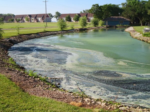
Thick blue-green algae coats a channel Tuesday near student housing units at Wright State University-Lake Campus off State Route 703.

Related online story:


CELINA - Microcystin algal toxin levels for Grand Lake are still reportedly below the threshold for no contact advisories, though officials caution lakegoers to stay away from algal blooms that look like paint spilled on the water. [More]
Additional pictures on this date