The Daily Standard
Pictures Archive
Menu
▼
Home
Subscribe
E-Edition
Archives
▼
Archives
Obituary Archives
Photo Albums
Podcasts
▼
Podcasts
Video
Classifieds
▼
Classifieds
Public Notices
Weather
Sports
More
▼
Contacts
Advertising
Subscription Payment
Community Pictures
Historical Maps
Forms
Locations
Elections
46°
46°
Mon
73°
Mon
73°
47°
47°
Tue
71°
Tue
71°
Friday, January 30th, 2026
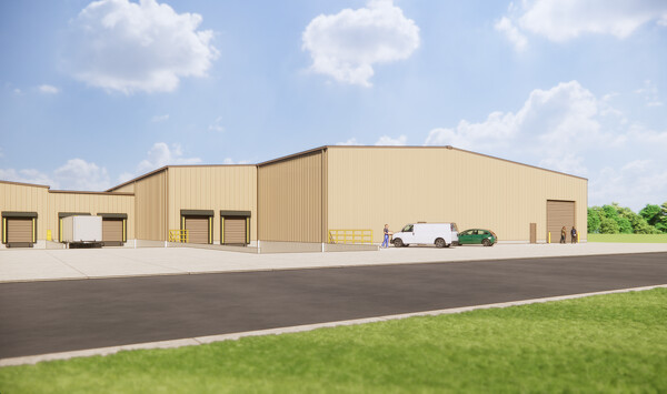
Submitted Photo
A rendering of Hi-Tech Wire and Manufacturing's upcoming 45,000-square-foot expansion.
Related online story:
St. Henry manufacturer expanding
ST. HENRY - A local manufacturing company is about to undergo its largest expansion yet, adding 45,000 square feet to its plant and creating five to 10 jobs. [
More
]
Archive of January 30th, 2026
Buy this E-Edition
Additional pictures on this date
<!--Unsupported browser-->
Copyright © 2026 Standard Printing Co. All Rights Reserved