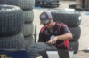
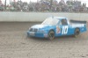
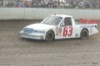
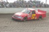
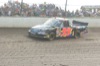
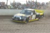
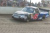
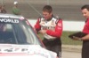
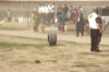
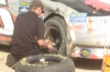
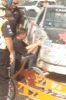
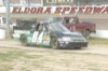
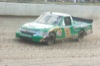
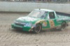
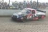
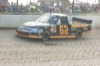
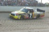
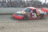
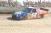
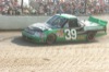
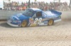
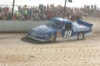
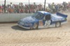
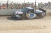
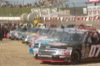
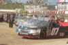
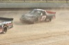
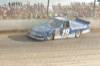
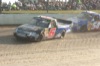
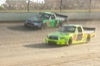
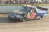
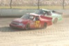
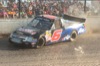
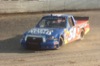
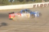
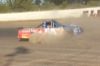
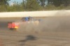
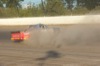
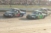
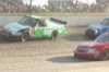
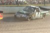
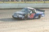
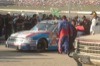
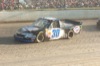
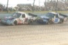
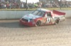
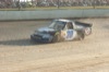
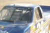
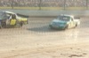
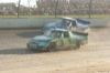
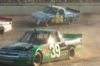
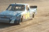
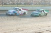
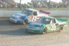
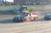
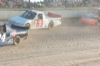
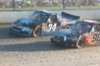
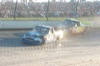
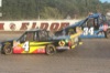
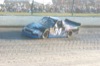
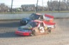
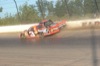
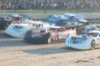
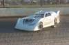
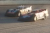
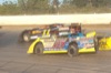
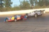
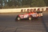
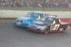
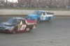
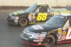
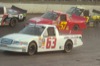
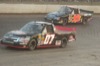
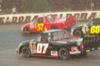
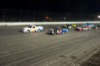
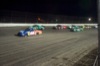
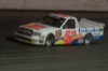
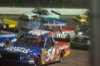
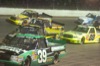
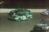
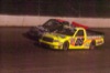
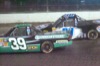
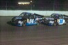
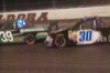
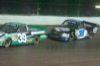
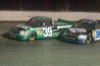
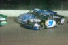
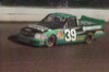
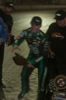
NASCAR Trucks at Eldora Mudsummer Classic
169 of 184 pictures
Wednesday, July 24th, 2013
Photo by Mark Pummell/The Daily Standard
Severe Thunderstorm Watch issued June 14 at 1:28PM EDT until June 14 at 9:00PM EDT by NWS Wilmington OH (details ...)
THE NATIONAL WEATHER SERVICE HAS ISSUED SEVERE THUNDERSTORM WATCH 333 IN EFFECT UNTIL 9 PM EDT THIS EVENING FOR THE FOLLOWING AREAS
IN INDIANA THIS WATCH INCLUDES 7 COUNTIES
IN EAST CENTRAL INDIANA
FAYETTE UNION WAYNE
IN SOUTHEAST INDIANA
DEARBORN FRANKLIN OHIO RIPLEY
IN KENTUCKY THIS WATCH INCLUDES 3 COUNTIES
IN NORTHERN KENTUCKY
BOONE CAMPBELL KENTON
IN OHIO THIS WATCH INCLUDES 32 COUNTIES
IN CENTRAL OHIO
DELAWARE FAIRFIELD FAYETTE FRANKLIN HOCKING LICKING MADISON PICKAWAY UNION
IN SOUTH CENTRAL OHIO
ADAMS HIGHLAND PIKE ROSS SCIOTO
IN SOUTHWEST OHIO
BROWN BUTLER CLERMONT CLINTON HAMILTON WARREN
IN WEST CENTRAL OHIO
AUGLAIZE CHAMPAIGN CLARK DARKE GREENE HARDIN LOGAN MERCER MIAMI MONTGOMERY PREBLE SHELBY
THIS INCLUDES THE CITIES OF ABERDEEN, ADA, ALEXANDRIA, AURORA, BATESVILLE, BEAVERCREEK, BELLEFONTAINE, BELLEVUE, BLANCHESTER, BRIGHT, BROOKVILLE, BURLINGTON, CAMDEN, CELINA, CHILLICOTHE, CIRCLEVILLE, COLDWATER, CONNERSVILLE, COVINGTON, DAY HEIGHTS, DAYTON, DELAWARE, DILLSBORO, DOWNTOWN CINCINNATI, DOWNTOWN COLUMBUS, DOWNTOWN DAYTON, EATON, ERLANGER, FAIRBORN, FAIRFIELD, FLORENCE, FORT THOMAS, FRANKLIN, GEORGETOWN, GREENDALE, GREENFIELD, GREENVILLE, HAMILTON, HIDDEN VALLEY, HIGHLAND HEIGHTS, HILLSBORO, INDEPENDENCE, KENTON, KETTERING, LANCASTER, LANDEN, LAWRENCEBURG, LEBANON, LIBERTY, LOGAN, LONDON, MANCHESTER, MARYSVILLE, MASON, MIDDLETOWN, MILAN, MILFORD, MINSTER, MOUNT CARMEL, MOUNT ORAB, MOUNT REPOSE, MULBERRY, NEW BREMEN, NEWARK, NEWPORT, OAKBROOK, OSGOOD, OXFORD, PEEBLES, PICKERINGTON, PIKE LAKE, PIKETON, PIQUA, PLAIN CITY, PORTSMOUTH, RICHMOND, RIPLEY, RISING SUN, SEAMAN, SIDNEY, SPRINGBORO, SPRINGFIELD, ST. MARYS, SUMMERSIDE, TIPP CITY, TROY, URBANA, VERSAILLES, WAPAKONETA, WASHINGTON COURT HOUSE, WAVERLY, WEST COLLEGE CORNER, WEST JEFFERSON, WEST UNION, WHEELERSBURG, WILMINGTON, WINCHESTER, WITHAMSVILLE, AND XENIA.
Special Weather Statement issued June 14 at 1:36PM EDT by NWS Wilmington OH (details ...)
At 134 PM EDT, a strong thunderstorm was located near Spencerville In Allen County, moving east at 40 mph.
HAZARD...Wind gusts up to 45 mph.
SOURCE...Radar indicated.
IMPACT...Gusty winds could knock down tree limbs and blow around unsecured objects.
Locations impacted include... Ada, Fort Shawnee, Cridersville, Alger, Waynesfield, Mcguffey, Buckland, and State Route 195 at State Route 235.
This includes I-75 in Ohio between mile markers 116 and 118.
If outdoors, consider seeking shelter inside a sturdy building.
A Severe Thunderstorm Watch remains in effect until 900 PM EDT for west central Ohio.
To report hazardous weather conditions, go to our website at weather.gov/iln and submit your report via social media, when you can do so safely.
Today 74° Today 74° slight chance 54° 54° Tomorrow 70° Tomorrow 70° 57° 57°
thum pict
thum pict
thum pict
thum pict
thum pict
thum pict
thum pict
thum pict
thum pict
thum pict
thum pict
thum pict
thum pict
thum pict
thum pict
thum pict
thum pict
thum pict
thum pict
thum pict
thum pict
thum pict
thum pict
thum pict
thum pict
thum pict
thum pict
thum pict
thum pict
thum pict
thum pict
thum pict
thum pict
thum pict
thum pict
thum pict
thum pict
thum pict
thum pict
thum pict
thum pict
thum pict
thum pict
thum pict
thum pict
thum pict
thum pict
thum pict
thum pict
thum pict
thum pict
thum pict
thum pict
thum pict
thum pict
thum pict
thum pict
thum pict
thum pict
thum pict
thum pict
thum pict
thum pict
thum pict
thum pict
thum pict
thum pict
thum pict
thum pict
thum pict
thum pict
thum pict
thum pict
thum pict
thum pict
thum pict
thum pict
thum pict
thum pict
thum pict
thum pict
thum pict
thum pict
thum pict
thum pict
thum pict
thum pict
thum pict
thum pict
thum pict
thum pict
thum pict
thum pict
thum pict
thum pict
thum pict
thum pict
thum pict
thum pict
thum pict
thum pict
thum pict
thum pict
thum pict
thum pict
thum pict
thum pict
thum pict
thum pict
thum pict
thum pict
thum pict
thum pict
thum pict
thum pict
thum pict
thum pict
thum pict
thum pict
thum pict
thum pict
thum pict
thum pict
thum pict
thum pict
thum pict
thum pict
thum pict
thum pict
thum pict
thum pict
thum pict
thum pict
thum pict
thum pict
thum pict
thum pict
thum pict
thum pict
thum pict
thum pict
thum pict
thum pict
thum pict
thum pict
thum pict
thum pict
thum pict
thum pict
thum pict
thum pict
thum pict
thum pict
thum pict
thum pict
thum pict
thum pict
thum pict
thum pict
thum pict
thum pict
thum pict
thum pict
thum pict
thum pict
thum pict
thum pict
thum pict
thum pict
thum pict
thum pict
thum pict
thum pict
thum pict
thum pict
thum pict
thum pict
thum pict
thum pict
thum pict
thum pict
thum pict
thum pict
thum pict