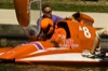
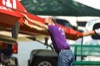
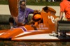
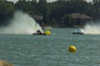
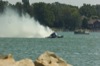
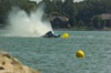
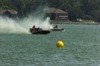
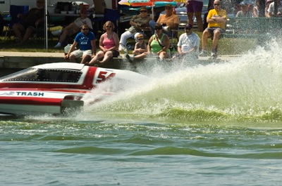
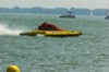
Governor's Cup Regatta
167 of 202 pictures
Sunday, August 25th, 2013
Photo by Mark Pummell/The Daily Standard
Flood Watch issued August 19 at 7:53PM EDT until August 20 at 10:00AM EDT by NWS Wilmington OH (details ...)
* WHAT...Flash flooding caused by excessive rainfall continues to be possible.

* WHERE...Portions of east central Indiana, including the following counties, Fayette, Union and Wayne and Ohio, including the following counties, Auglaize, Champaign, Clark, Darke, Delaware, Fairfield, Fayette, Franklin, Greene, Hardin, Hocking, Licking, Logan, Madison, Mercer, Miami, Montgomery, Pickaway, Preble, Shelby and Union.
* WHEN...Through Thursday morning.
* IMPACTS...Excessive runoff may result in flooding of rivers, creeks, streams, and other low-lying and flood-prone locations.
* ADDITIONAL DETAILS... - Repeated rounds of storms, combined with the extremely wet soil conditions will increase the risk for flash flooding into the overnight hours.
Flood Warning issued August 19 at 10:36PM EDT until August 20 at 7:00AM EDT by NWS Wilmington OH (details ...)
* WHAT...Flooding caused by excessive rainfall continues.
* WHERE...Southeastern Auglaize County in west central Ohio... Southern Logan County in west central Ohio... Central Shelby County in west central Ohio...
* WHEN...Until 700 AM EDT Thursday.
* IMPACTS...Flooding of rivers, creeks, streams, and other low-lying and flood-prone locations is imminent or occurring.
* ADDITIONAL DETAILS... - At 1036 PM EDT, emergency management reported flooding in the warned area. Between 3 and 6 inches of rain have fallen. Additional rainfall amounts up to 0.5 inches are possible. - Some locations that may experience flooding include... Sidney, Bellefontaine, Newport, West Liberty, Anna, Fort Loramie, De Graff, Quincy, Port Jefferson, Valley Hi, Zanesfield, Maplewood, Pemberton, Logansville, Mcmorran, Swanders, Pickrelltown, New Jerusalem and Lake Loramie State Park.
63° 63° Thu 78° Thu 78° 59° 59° Fri 79° Fri 79°
thum pict
thum pict
thum pict
thum pict
thum pict
thum pict
thum pict
thum pict
thum pict
thum pict
thum pict
thum pict
thum pict
thum pict
thum pict
thum pict
thum pict
thum pict
thum pict
thum pict
thum pict
thum pict
thum pict
thum pict
thum pict
thum pict
thum pict
thum pict
thum pict
thum pict
thum pict
thum pict
thum pict
thum pict
thum pict
thum pict
thum pict
thum pict
thum pict
thum pict
thum pict
thum pict
thum pict
thum pict
thum pict
thum pict
thum pict
thum pict
thum pict
thum pict
thum pict
thum pict
thum pict
thum pict
thum pict
thum pict
thum pict
thum pict
thum pict
thum pict
thum pict
thum pict
thum pict
thum pict
thum pict
thum pict
thum pict
thum pict
thum pict
thum pict
thum pict
thum pict
thum pict
thum pict
thum pict
thum pict
thum pict
thum pict
thum pict
thum pict
thum pict
thum pict
thum pict
thum pict
thum pict
thum pict
thum pict
thum pict
thum pict
thum pict
thum pict
thum pict
thum pict
thum pict
thum pict
thum pict
thum pict
thum pict
thum pict
thum pict
thum pict
thum pict
thum pict
thum pict
thum pict
thum pict
thum pict
thum pict
thum pict
thum pict
thum pict
thum pict
thum pict
thum pict
thum pict
thum pict
thum pict
thum pict
thum pict
thum pict
thum pict
thum pict
thum pict
thum pict
thum pict
thum pict
thum pict
thum pict
thum pict
thum pict
thum pict
thum pict
thum pict
thum pict
thum pict
thum pict
thum pict
thum pict
thum pict
thum pict
thum pict
thum pict
thum pict
thum pict
thum pict
thum pict
thum pict
thum pict
thum pict
thum pict
thum pict
thum pict
thum pict
thum pict
thum pict
thum pict
thum pict
thum pict
thum pict
thum pict
thum pict
thum pict
thum pict
thum pict
thum pict
thum pict
thum pict
thum pict
thum pict
thum pict
thum pict
thum pict
thum pict
thum pict
thum pict
thum pict
thum pict
thum pict
thum pict
thum pict
thum pict
thum pict
thum pict
thum pict
thum pict
thum pict
thum pict
thum pict
thum pict
thum pict
thum pict
thum pict
thum pict
thum pict
thum pict
thum pict
thum pict
thum pict
thum pict
thum pict
thum pict
thum pict