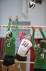
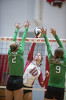
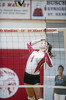
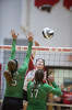
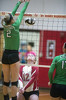
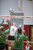
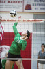
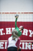
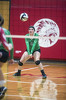
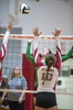
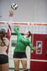
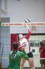
St. Henry vs Celina volleyball
29 of 121 pictures
Tuesday, August 29th, 2017
Photo by Mark Pummell/The Daily Standard
Extreme Cold Watch issued January 25 at 1:42AM EST until January 27 at 12:00PM EST by NWS Wilmington OH (details ...)
* WHAT...For the Cold Weather Advisory, very cold wind chills as low as around 15 below zero expected. For the Extreme Cold Watch, dangerously cold wind chills as low as around 25 below zero possible.
* WHERE...Portions of east central and southeast Indiana, northeast and northern Kentucky, and central, south central, southwest, and west central Ohio.
* WHEN...For the Cold Weather Advisory, from midnight tonight to 6 PM EST Monday. For the Extreme Cold Watch, from Monday evening through Tuesday morning.
* IMPACTS...The dangerously cold wind chills could cause frostbite on exposed skin in as little as 30 minutes.
Cold Weather Advisory issued January 25 at 1:42AM EST until January 26 at 6:00PM EST by NWS Wilmington OH (details ...)
* WHAT...For the Cold Weather Advisory, very cold wind chills as low as around 15 below zero expected. For the Extreme Cold Watch, dangerously cold wind chills as low as around 25 below zero possible.
* WHERE...Portions of east central and southeast Indiana, northeast and northern Kentucky, and central, south central, southwest, and west central Ohio.
* WHEN...For the Cold Weather Advisory, from midnight tonight to 6 PM EST Monday. For the Extreme Cold Watch, from Monday evening through Tuesday morning.
* IMPACTS...The dangerously cold wind chills could cause frostbite on exposed skin in as little as 30 minutes.
Winter Storm Warning issued January 25 at 1:41AM EST until January 26 at 12:00PM EST by NWS Wilmington OH (details ...)
* WHAT...Heavy snow. Additional snow accumulations between 7 and 11 inches.
* WHERE...Auglaize, Darke, Hardin, Logan, Mercer, and Shelby Counties.
* WHEN...Until noon EST Monday.
* IMPACTS...Travel will be very difficult. The hazardous conditions could impact the Monday morning commute.
Sun 16° Sun 16° heavy heavy likely Mon 10° Mon 10° slight chance chance
thum pict
thum pict
thum pict
thum pict
thum pict
thum pict
thum pict
thum pict
thum pict
thum pict
thum pict
thum pict
thum pict
thum pict
thum pict
thum pict
thum pict
thum pict
thum pict
thum pict
thum pict
thum pict
thum pict
thum pict
thum pict
thum pict
thum pict
thum pict
thum pict
thum pict
thum pict
thum pict
thum pict
thum pict
thum pict
thum pict
thum pict
thum pict
thum pict
thum pict
thum pict
thum pict
thum pict
thum pict
thum pict
thum pict
thum pict
thum pict
thum pict
thum pict
thum pict
thum pict
thum pict
thum pict
thum pict
thum pict
thum pict
thum pict
thum pict
thum pict
thum pict
thum pict
thum pict
thum pict
thum pict
thum pict
thum pict
thum pict
thum pict
thum pict
thum pict
thum pict
thum pict
thum pict
thum pict
thum pict
thum pict
thum pict
thum pict
thum pict
thum pict
thum pict
thum pict
thum pict
thum pict
thum pict
thum pict
thum pict
thum pict
thum pict
thum pict
thum pict
thum pict
thum pict
thum pict
thum pict
thum pict
thum pict
thum pict
thum pict
thum pict
thum pict
thum pict
thum pict
thum pict
thum pict
thum pict
thum pict
thum pict
thum pict
thum pict
thum pict
thum pict
thum pict
thum pict
thum pict
thum pict
thum pict
thum pict
thum pict
thum pict