Celina Tornado - Bruns Addition and Wheatland Acres

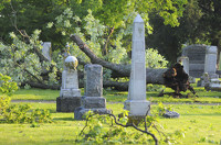
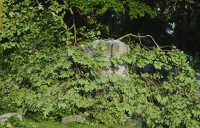
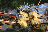
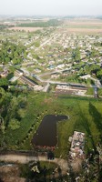
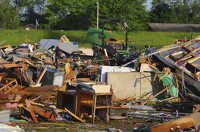
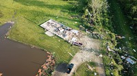
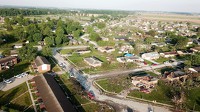
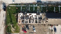
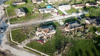
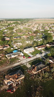
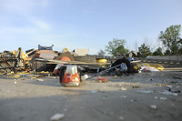
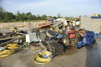
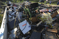
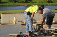
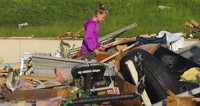
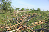
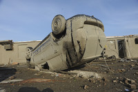
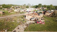
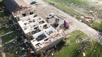
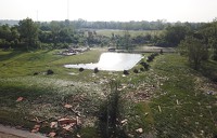
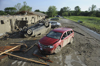
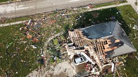
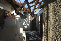
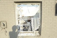
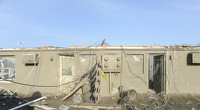
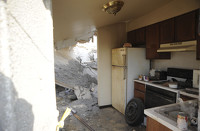
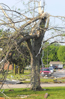
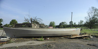
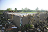
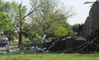
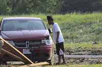
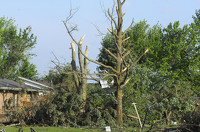
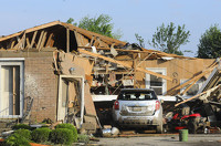
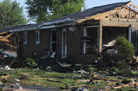
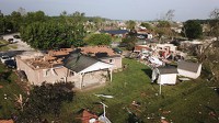
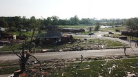
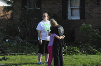
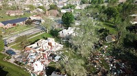
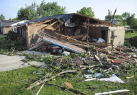
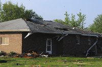
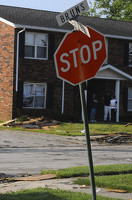
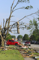
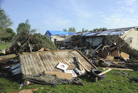
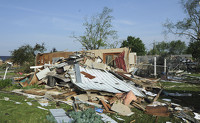
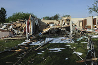
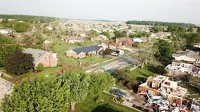
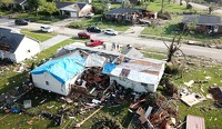
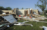
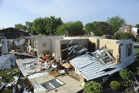
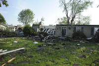
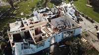
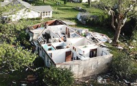
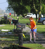
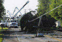
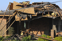
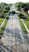
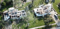
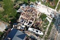
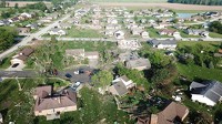
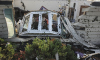
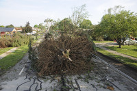
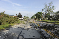
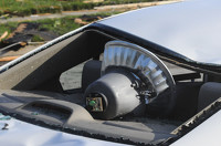
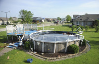
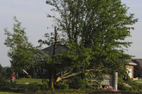
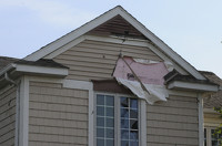
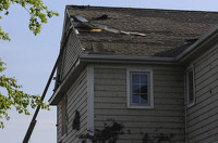
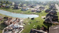
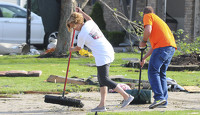
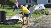
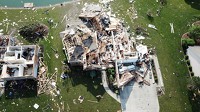
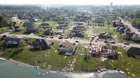
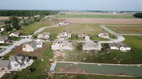
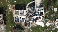
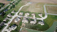
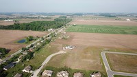
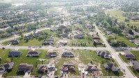
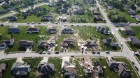
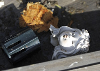
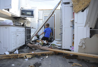
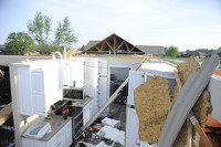
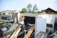
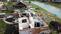
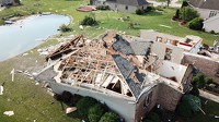
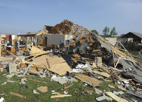
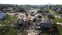
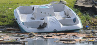
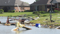
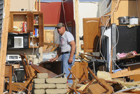
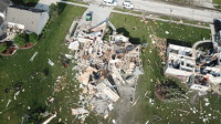
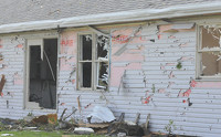
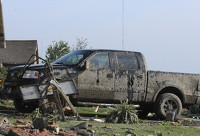
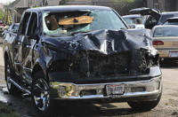
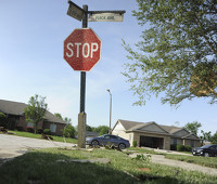
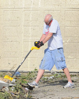
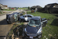
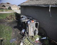
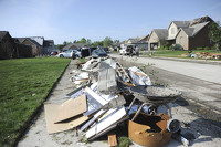
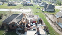
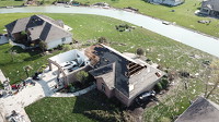
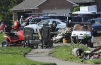
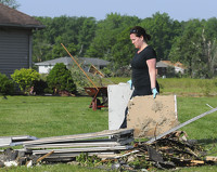
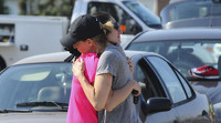
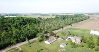
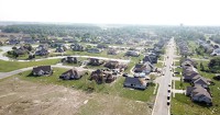
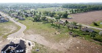
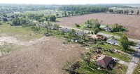
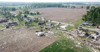
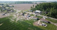
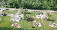
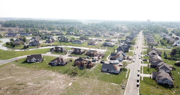
CELINA - At least seven people were seriously injured and multiple homes devastated when a tornado tore through northwestern Celina on Monday night. Find links to all other tornado coverage on this page including stories, map, albums and video.

112 of 117 pictures
Tuesday, May 28th, 2019
Photo by Daily Standard Staff
Cold Weather Advisory issued December 13 at 6:08PM EST until December 15 at 11:00AM EST by NWS Wilmington OH (details ...)
* WHAT...Very cold wind chills as low as 17 below zero expected.
* WHERE...Portions of east central and southeast Indiana, northeast and northern Kentucky, and central, south central, southwest, and west central Ohio.
* WHEN...Until 11 AM EST Monday.
* IMPACTS...The cold wind chills as low as 15 below zero could result in hypothermia or frostbite if precautions are not taken.
Winter Weather Advisory issued December 13 at 6:05PM EST until December 14 at 7:00AM EST by NWS Wilmington OH (details ...)
* WHAT...Snow tapering off this evening. Total snow accumulations of 3 to 5 inches.
* WHERE...Delaware, Union, Auglaize, Champaign, Darke, Hardin, Logan, Mercer, Miami, and Shelby Counties.
* WHEN...Until 7 AM EST Sunday.
* IMPACTS...Plan on slippery road conditions.
chance Sun 17° Sun 17° Mon 21° Mon 21°
thum pict
thum pict
thum pict
thum pict
thum pict
thum pict
thum pict
thum pict
thum pict
thum pict
thum pict
thum pict
thum pict
thum pict
thum pict
thum pict
thum pict
thum pict
thum pict
thum pict
thum pict
thum pict
thum pict
thum pict
thum pict
thum pict
thum pict
thum pict
thum pict
thum pict
thum pict
thum pict
thum pict
thum pict
thum pict
thum pict
thum pict
thum pict
thum pict
thum pict
thum pict
thum pict
thum pict
thum pict
thum pict
thum pict
thum pict
thum pict
thum pict
thum pict
thum pict
thum pict
thum pict
thum pict
thum pict
thum pict
thum pict
thum pict
thum pict
thum pict
thum pict
thum pict
thum pict
thum pict
thum pict
thum pict
thum pict
thum pict
thum pict
thum pict
thum pict
thum pict
thum pict
thum pict
thum pict
thum pict
thum pict
thum pict
thum pict
thum pict
thum pict
thum pict
thum pict
thum pict
thum pict
thum pict
thum pict
thum pict
thum pict
thum pict
thum pict
thum pict
thum pict
thum pict
thum pict
thum pict
thum pict
thum pict
thum pict
thum pict
thum pict
thum pict
thum pict
thum pict
thum pict
thum pict
thum pict
thum pict
thum pict
thum pict
thum pict
thum pict
thum pict
thum pict
thum pict
thum pict
thum pict