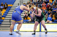
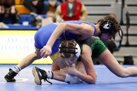
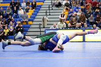
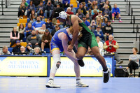
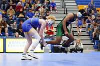
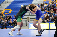
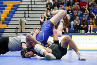
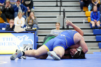
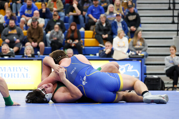
St. Marys vs Celina wrestling
237 of 252 pictures
Thursday, December 21st, 2023
Photo by Paige Sutter/The Daily Standard
Severe Thunderstorm Watch issued May 19 at 4:39PM EDT until May 19 at 10:00PM EDT by NWS Wilmington OH (details ...)
THE NATIONAL WEATHER SERVICE HAS ISSUED SEVERE THUNDERSTORM WATCH 231 IN EFFECT UNTIL 10 PM EDT THIS EVENING FOR THE FOLLOWING AREAS
IN INDIANA THIS WATCH INCLUDES 6 COUNTIES
IN EAST CENTRAL INDIANA
FAYETTE UNION WAYNE
IN SOUTHEAST INDIANA
DEARBORN FRANKLIN RIPLEY
IN OHIO THIS WATCH INCLUDES 16 COUNTIES
IN CENTRAL OHIO
UNION
IN SOUTHWEST OHIO
BUTLER HAMILTON WARREN
IN WEST CENTRAL OHIO
AUGLAIZE CHAMPAIGN CLARK DARKE GREENE HARDIN LOGAN MERCER MIAMI MONTGOMERY PREBLE SHELBY
THIS INCLUDES THE CITIES OF ADA, AURORA, BATESVILLE, BEAVERCREEK, BELLEFONTAINE, BRIGHT, BROOKVILLE, CAMDEN, CELINA, COLDWATER, CONNERSVILLE, DILLSBORO, DOWNTOWN CINCINNATI, DOWNTOWN DAYTON, EATON, FAIRBORN, FAIRFIELD, FRANKLIN, GREENDALE, GREENVILLE, HAMILTON, HIDDEN VALLEY, KENTON, KETTERING, LANDEN, LAWRENCEBURG, LEBANON, LIBERTY, MARYSVILLE, MASON, MIDDLETOWN, MILAN, MINSTER, NEW BREMEN, OSGOOD, OXFORD, PIQUA, RICHMOND, SIDNEY, SPRINGBORO, SPRINGFIELD, ST. MARYS, TIPP CITY, TROY, URBANA, VERSAILLES, WAPAKONETA, WEST COLLEGE CORNER, AND XENIA.
Special Weather Statement issued May 19 at 6:18PM EDT by NWS Wilmington OH (details ...)
At 618 PM EDT, a strong thunderstorm was located over Wapakoneta, moving northeast at 35 mph.
HAZARD...Wind gusts up to 50 mph and pea size hail.
SOURCE...Radar indicated.
IMPACT...Gusty winds could knock down tree limbs and blow around unsecured objects. Hail may cause minor damage to vegetation.
Locations impacted include... Wapakoneta, Ada, Fort Shawnee, Cridersville, Dunkirk, Alger, Waynesfield, Blanchard, Roundhead, Mcguffey, Uniopolis, Dola, Fryburg, Jumbo, Huntersville, St. Johns, Walton, New Hampshire, and State Route 195 at State Route 235.
This includes I-75 in Ohio between mile markers 106 and 118.
If outdoors, consider seeking shelter inside a sturdy building.
A Severe Thunderstorm Watch remains in effect until 1000 PM EDT for west central Ohio.
To report hazardous weather conditions, go to our website at weather.gov/iln and submit your report via social media, when you can do so safely.
Special Weather Statement issued May 19 at 6:06PM EDT by NWS Wilmington OH (details ...)
At 605 PM EDT, a strong thunderstorm was located over New Knoxville, moving northeast at 35 mph.
HAZARD...Wind gusts up to 45 mph and half inch hail.
SOURCE...Radar indicated.
IMPACT...Gusty winds could knock down tree limbs and blow around unsecured objects. Hail may cause minor damage to vegetation.
Locations impacted include... Wapakoneta, St. Marys, Fort Shawnee, New Bremen, Minster, Cridersville, Botkins, New Knoxville, Waynesfield, Moulton, Buckland, Uniopolis, Kettlersville, Fryburg, Lake Loramie State Park, St. Johns, and Bulkhead.
This includes I-75 in Ohio between mile markers 104 and 118.
If outdoors, consider seeking shelter inside a sturdy building.
A Severe Thunderstorm Watch remains in effect until 1000 PM EDT for west central Ohio.
To report hazardous weather conditions, go to our website at weather.gov/iln and submit your report via social media, when you can do so safely.
Today 88° Today 88° slight chance chance 60° 60° likely Tomorrow 68° Tomorrow 68° chance 47° 47°
thum pict
thum pict
thum pict
thum pict
thum pict
thum pict
thum pict
thum pict
thum pict
thum pict
thum pict
thum pict
thum pict
thum pict
thum pict
thum pict
thum pict
thum pict
thum pict
thum pict
thum pict
thum pict
thum pict
thum pict
thum pict
thum pict
thum pict
thum pict
thum pict
thum pict
thum pict
thum pict
thum pict
thum pict
thum pict
thum pict
thum pict
thum pict
thum pict
thum pict
thum pict
thum pict
thum pict
thum pict
thum pict
thum pict
thum pict
thum pict
thum pict
thum pict
thum pict
thum pict
thum pict
thum pict
thum pict
thum pict
thum pict
thum pict
thum pict
thum pict
thum pict
thum pict
thum pict
thum pict
thum pict
thum pict
thum pict
thum pict
thum pict
thum pict
thum pict
thum pict
thum pict
thum pict
thum pict
thum pict
thum pict
thum pict
thum pict
thum pict
thum pict
thum pict
thum pict
thum pict
thum pict
thum pict
thum pict
thum pict
thum pict
thum pict
thum pict
thum pict
thum pict
thum pict
thum pict
thum pict
thum pict
thum pict
thum pict
thum pict
thum pict
thum pict
thum pict
thum pict
thum pict
thum pict
thum pict
thum pict
thum pict
thum pict
thum pict
thum pict
thum pict
thum pict
thum pict
thum pict
thum pict
thum pict
thum pict
thum pict
thum pict
thum pict
thum pict
thum pict
thum pict
thum pict
thum pict
thum pict
thum pict
thum pict
thum pict
thum pict
thum pict
thum pict
thum pict
thum pict
thum pict
thum pict
thum pict
thum pict
thum pict
thum pict
thum pict
thum pict
thum pict
thum pict
thum pict
thum pict
thum pict
thum pict
thum pict
thum pict
thum pict
thum pict
thum pict
thum pict
thum pict
thum pict
thum pict
thum pict
thum pict
thum pict
thum pict
thum pict
thum pict
thum pict
thum pict
thum pict
thum pict
thum pict
thum pict
thum pict
thum pict
thum pict
thum pict
thum pict
thum pict
thum pict
thum pict
thum pict
thum pict
thum pict
thum pict
thum pict
thum pict
thum pict
thum pict
thum pict
thum pict
thum pict
thum pict
thum pict
thum pict
thum pict
thum pict
thum pict
thum pict
thum pict
thum pict
thum pict
thum pict
thum pict
thum pict
thum pict
thum pict
thum pict
thum pict
thum pict
thum pict
thum pict
thum pict
thum pict
thum pict
thum pict
thum pict
thum pict
thum pict
thum pict
thum pict
thum pict
thum pict
thum pict
thum pict
thum pict
thum pict
thum pict
thum pict
thum pict
thum pict
thum pict
thum pict
thum pict
thum pict
thum pict
thum pict
thum pict
thum pict
thum pict
thum pict
thum pict
thum pict
thum pict
thum pict
thum pict
thum pict
thum pict
thum pict
thum pict
thum pict
thum pict
thum pict
thum pict