Flood Watch issued August 14 at 9:48PM EDT until August 16 at 8:00AM EDT by NWS Wilmington OH (details ...)
* WHAT...Flash flooding caused by excessive rainfall continues to be possible.
* WHERE...Portions of Indiana, including the following counties, Fayette, Franklin, Union and Wayne and Ohio, including the following counties, Auglaize, Butler, Champaign, Clark, Clinton, Darke, Delaware, Fairfield, Fayette, Franklin, Greene, Hardin, Hocking, Licking, Logan, Madison, Mercer, Miami, Montgomery, Pickaway, Preble, Ross, Shelby, Union and Warren.
* WHEN...From Saturday afternoon through Sunday morning.
* IMPACTS...Excessive runoff may result in flooding of rivers, creeks, streams, and other low-lying and flood-prone locations.
* ADDITIONAL DETAILS... - Another round of showers and thunderstorms is expected to move through the region Saturday into Saturday night. Additional heavy rainfall may result in flash flooding.
67° 67° Sat 84° Sat 84° slight chance likely 72° 72° likely Sun 86° Sun 86° chance
Friday, October 12th, 2007
Photo by Mark Pummell/The Daily Standard

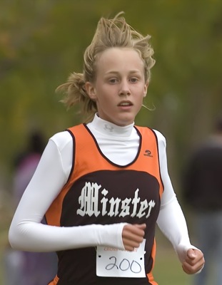
St. Henry's Doug Ranly finished third in the Midwest Athletic Conference cross country meet on Thursday evening in Coldwater.

Related online story:


COLDWATER - The Midwest Athletic Conference meet was run on a cold, windy evening in Coldwater, much different than the hot and humid weather all these teams faced when they ran in the Lion's Invitational on this same course just one week ago. [More]
Additional pictures on this date