Special Weather Statement issued May 1 at 12:13PM EDT by NWS Wilmington OH (details ...)
At 1212 PM EDT, a strong thunderstorm was located near New Bremen, moving northeast at 50 mph.
HAZARD...Wind gusts up to 45 mph and pea size hail.
SOURCE...Radar indicated.
IMPACT...Gusty winds could knock down tree limbs and blow around unsecured objects. Hail may cause minor damage to vegetation.
Locations impacted include... Newport, Fryburg, Montra, Egypt, Uniopolis, New Bremen, Buckland, Botkins, New Knoxville, Fort Loramie, Kettlersville, Moulton, Jackson Center, St. Marys, Anna, Kossuth, Lakeview, Lake Loramie State Park, Waynesfield, and Wapakoneta.
This includes I-75 in Ohio between mile markers 96 and 118.
If outdoors, consider seeking shelter inside a sturdy building.
To report hazardous weather conditions, go to our website at weather.gov/iln and submit your report via social media, when you can do so safely.
Today 74° Today 74° 58° 58° chance Tomorrow 71° Tomorrow 71° chance 54° 54° chance
Tuesday, February 5th, 2008
Photo by Mark Pummell/The Daily Standard

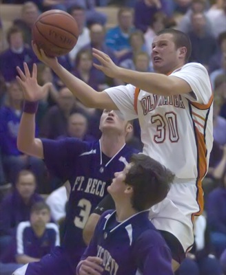
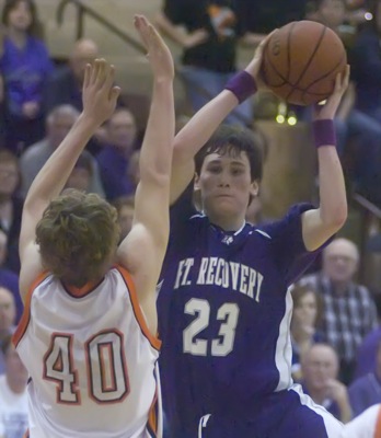
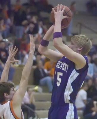
Coldwater's Tony Harlamert, 30, drives in the middle of the Fort Recovery defense to attempt a layup during their Midwest Athletic Conference contest on Monday night at The Palace in a rescheduled game from earlier in the year. The Indians defeated the Cavaliers for the second time this season, 49-48.

Related online story:
COLDWATER - The second meeting between Fort Recovery and Coldwater proved to be just as exciting as the first meeting at the end of December.
Greg [More]
Additional pictures on this date