Special Weather Statement issued May 1 at 12:13PM EDT by NWS Wilmington OH (details ...)
At 1212 PM EDT, a strong thunderstorm was located near New Bremen, moving northeast at 50 mph.
HAZARD...Wind gusts up to 45 mph and pea size hail.
SOURCE...Radar indicated.
IMPACT...Gusty winds could knock down tree limbs and blow around unsecured objects. Hail may cause minor damage to vegetation.
Locations impacted include... Newport, Fryburg, Montra, Egypt, Uniopolis, New Bremen, Buckland, Botkins, New Knoxville, Fort Loramie, Kettlersville, Moulton, Jackson Center, St. Marys, Anna, Kossuth, Lakeview, Lake Loramie State Park, Waynesfield, and Wapakoneta.
This includes I-75 in Ohio between mile markers 96 and 118.
If outdoors, consider seeking shelter inside a sturdy building.
To report hazardous weather conditions, go to our website at weather.gov/iln and submit your report via social media, when you can do so safely.
Today 74° Today 74° 58° 58° chance Tomorrow 71° Tomorrow 71° chance 54° 54° chance
Friday, August 15th, 2008
Photo by Nancy Allen/The Daily Standard

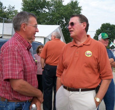
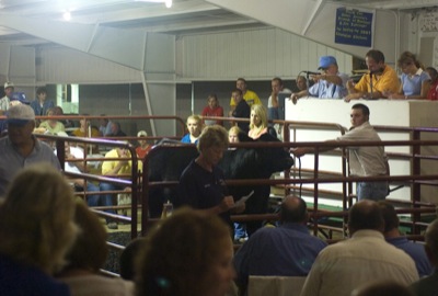
Ohio Department of Agriculture Director Robert Boggs, right, talks with Bob Pohlman, a supervisor with the Mercer County Soil and Water Conservation District on Thursday at the Mercer County Fair. Boggs is making the rounds of many county fairs in the state talking with ag officials.

Related online story:
The director of the Ohio Department of Agriculture (ODA) said the state should continue to pursue ethanol as an alternative energy source despite continued high grain costs crushing many livestock producers. [More]
Additional pictures on this date