Severe Thunderstorm Watch issued September 5 at 2:36AM EDT until September 5 at 8:00AM EDT by NWS Wilmington OH (details ...)
THE NATIONAL WEATHER SERVICE HAS ISSUED SEVERE THUNDERSTORM WATCH 655 IN EFFECT UNTIL 8 AM EDT THIS MORNING FOR THE FOLLOWING AREAS
IN OHIO THIS WATCH INCLUDES 11 COUNTIES
IN CENTRAL OHIO
DELAWARE FAIRFIELD FRANKLIN LICKING UNION
IN WEST CENTRAL OHIO
AUGLAIZE CHAMPAIGN HARDIN LOGAN MERCER SHELBY
THIS INCLUDES THE CITIES OF ADA, BELLEFONTAINE, CELINA, COLDWATER, DELAWARE, DOWNTOWN COLUMBUS, KENTON, LANCASTER, MARYSVILLE, MINSTER, NEW BREMEN, NEWARK, PICKERINGTON, SIDNEY, ST. MARYS, URBANA, AND WAPAKONETA.
69° 69° chance Sat 84° Sat 84° chance slight chance 60° 60° chance Sun 79° Sun 79°
Friday, April 24th, 2009
Photo by Frank Snyder/The Daily Standard

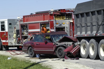
A car is embedded in the rear of a dump truck following an accident that claimed the lives of two Indiana residents on Thursday morning at the intersection of state Routes 29 and 118, west of Celina.

Related online story:

An Indiana woman and her father-in-law were killed when their car slammed into the rear of a dump truck at the intersection of state Routes 29 and 118 Thursday morning. [More]
Additional pictures on this date