Flood Advisory issued July 27 at 9:30PM EDT until July 28 at 12:30AM EDT by NWS Wilmington OH (details ...)
* WHAT...Flooding caused by excessive rainfall is expected.
* WHERE...The following counties, in west central Ohio, Darke and Mercer.
* WHEN...Until 1230 AM EDT.
* IMPACTS...Minor flooding in low-lying and poor drainage areas.
* ADDITIONAL DETAILS... - At 929 PM EDT, radar indicated heavy rain due to thunderstorms. Minor flooding is ongoing or expected to begin shortly in the advisory area. Between 0.5 and 1.5 inches of rain have fallen. Additional rainfall amounts of 0.5 to 1 inch are possible. - Some locations that may experience flooding include... Fort Recovery, Sharps Crossing, Greenville, Coldwater, Union City, St. Henry, Ansonia, Burkettsville, North Star, Rossburg, New Weston, Rose Hill, Brock, Cosmos, andPikeville.
73° 73° slight chance Mon 88° Mon 88° chance 73° 73° slight chance Tue 91° Tue 91° slight chance
Thursday, June 25th, 2009
Photo by Mark Pummell/The Daily Standard

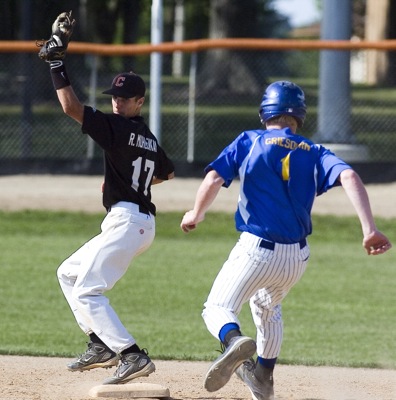
Coldwater's Randal Muhlenkamp, left, steps on second base for an out as Marion Local's Jarren Griesdorn, right, begins his slide during ACME action on Wednesday. Coldwater swept the doubleheader.

Additional pictures on this date