Special Weather Statement issued August 7 at 11:33PM EDT by NWS Wilmington OH (details ...)
At 1133 PM EDT, a strong thunderstorm was located near Wapakoneta, moving northeast at 35 mph.
HAZARD...Wind gusts up to 45 mph and very heavy rain.
SOURCE...Radar indicated.
IMPACT...Gusty winds could knock down tree limbs and blow around unsecured objects. Visibility will be poor and hydroplaning is possible.
Locations impacted include... Wapakoneta, Ada, Fort Shawnee, Cridersville, Jackson Center, Russells Point, Botkins, Lakeview, Alger, Waynesfield, Belle Center, Chippewa Park, Roundhead, Mcguffey, Uniopolis, Fryburg, Montra, Silver Creek, Jumbo, and Huntersville.
This includes I-75 in Ohio between mile markers 101 and 118.
If outdoors, consider seeking shelter inside a sturdy building.
Motorists should slow down and use extra caution.
To report hazardous weather conditions, go to our website at weather.gov/iln and submit your report via social media, when you can do so safely.
68° 68° chance likely Sat 84° Sat 84° patchy 61° 61° slight chance Sun 84° Sun 84° slight chance
Friday, September 16th, 2011
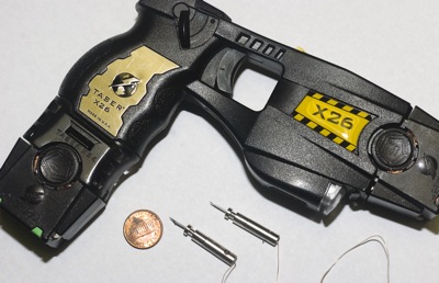
Photo by Mark Pummell/The Daily Standard

Local law enforcement officials say Tasers offer an alternative to deadly force, keep officers safe and inflict no permanent harm on those who receive the electroshock.

Related online story:

Many law enforcement officers in Mercer and Auglaize counties wear two holsters - one for a weapon of deadly force and the other for a Taser stun gun [More]
Additional pictures on this date