Severe Thunderstorm Warning issued August 10 at 9:49PM EDT until August 10 at 10:30PM EDT by NWS Wilmington OH (details ...)
SVRILN The National Weather Service in Wilmington has issued a * Severe Thunderstorm Warning for... Northeastern Shelby County in west central Ohio... Southern Auglaize County in west central Ohio... Central Mercer County in west central Ohio... * Until 1030 PM EDT. * At 948 PM EDT, a severe thunderstorm was located near St. Marys, moving southeast at 45 mph. HAZARD...60 mph wind gusts and quarter size hail. SOURCE...Radar indicated. IMPACT...Minor hail damage to vehicles is possible. Expect wind damage to trees and power lines. * Locations impacted include... Celina, Wapakoneta, St. Marys, Coldwater, New Bremen, Minster, Anna, Jackson Center, Botkins, New Knoxville, Moulton, Wabash, Port Jefferson, Kettlersville, Montezuma, Fryburg, Montra, Tama, Neptune, and Maplewood. This includes I-75 in Ohio between mile markers 96 and 112.
Severe Thunderstorm Warning issued August 10 at 9:29PM EDT until August 10 at 10:15PM EDT by NWS Wilmington OH (details ...)
SVRILN The National Weather Service in Wilmington has issued a * Severe Thunderstorm Warning for... Northwestern Auglaize County in west central Ohio... Northern Mercer County in west central Ohio... * Until 1015 PM EDT. * At 929 PM EDT, a severe thunderstorm was located near Ohio City, moving east at 35 mph. HAZARD...60 mph wind gusts and quarter size hail. SOURCE...Radar indicated. IMPACT...Minor hail damage to vehicles is possible. Expect wind damage to trees and power lines. * Locations impacted include... Wapakoneta, Fort Shawnee, Cridersville, Rockford, Mendon, Buckland, Uniopolis, Chattanooga, Kossuth, Tama, St. Johns, Neptune, and State Route 116 at State Route 197. This includes I-75 in Ohio between mile markers 111 and 118.
Severe Thunderstorm Watch issued August 10 at 7:26PM EDT until August 11 at 2:00AM EDT by NWS Wilmington OH (details ...)
THE NATIONAL WEATHER SERVICE HAS ISSUED SEVERE THUNDERSTORM WATCH 560 IN EFFECT UNTIL 2 AM EDT TUESDAY FOR THE FOLLOWING AREAS IN INDIANA THIS WATCH INCLUDES 1 COUNTY IN EAST CENTRAL INDIANA WAYNE IN OHIO THIS WATCH INCLUDES 21 COUNTIES IN CENTRAL OHIO DELAWARE FAIRFIELD FAYETTE FRANKLIN HOCKING LICKING MADISON PICKAWAY UNION IN WEST CENTRAL OHIO AUGLAIZE CHAMPAIGN CLARK DARKE GREENE HARDIN LOGAN MERCER MIAMI MONTGOMERY PREBLE SHELBY THIS INCLUDES THE CITIES OF ADA, BEAVERCREEK, BELLEFONTAINE, CAMDEN, CELINA, CIRCLEVILLE, COLDWATER, DELAWARE, DOWNTOWN COLUMBUS, DOWNTOWN DAYTON, EATON, FAIRBORN, GREENVILLE, KENTON, KETTERING, LANCASTER, LOGAN, LONDON, MARYSVILLE, MINSTER, NEW BREMEN, NEWARK, PICKERINGTON, PIQUA, PLAIN CITY, RICHMOND, SIDNEY, SPRINGFIELD, ST. MARYS, TIPP CITY, TROY, URBANA, WAPAKONETA, WASHINGTON COURT HOUSE, WEST JEFFERSON, AND XENIA.
Flood Watch issued August 10 at 1:04PM EDT until August 12 at 8:00AM EDT by NWS Wilmington OH (details ...)
* WHAT...Flash flooding caused by excessive rainfall is possible. * WHERE...Portions of Indiana, including the following counties, Dearborn, Fayette, Franklin, Union and Wayne, Kentucky, including the following counties, Boone, Bracken, Campbell, Kenton, Lewis, Mason, Pendleton and Robertson, and Ohio, including the following counties, Adams, Auglaize, Brown, Butler, Champaign, Clark, Clermont, Clinton, Darke, Delaware, Fairfield, Fayette, Franklin, Greene, Hamilton, Hardin, Highland, Hocking, Licking, Logan, Madison, Mercer, Miami, Montgomery, Pickaway, Pike, Preble, Ross, Scioto, Shelby, Union and Warren. * WHEN...Through Wednesday morning. * IMPACTS...Excessive runoff may result in flooding of rivers, creeks, streams, and other low-lying and flood-prone locations. * ADDITIONAL DETAILS... - Several rounds of thunderstorms are expected through Tuesday night. Locally heavy rainfall can be expected with the potential for storms to repeatedly track over the same locations. This will result in the potential for flash flooding.
Patricia E. "Mama Bear" Deubler, 60, St. Marys, died at 3:59 a.m. Nov. 14, 2011, in the emergency department of Joint Township District Memorial Hospital. [More]
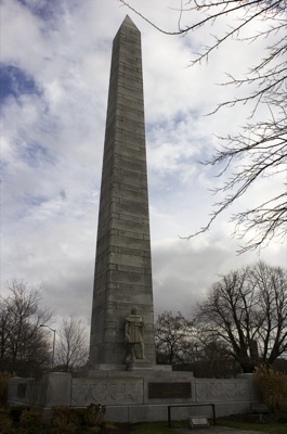
FORT RECOVERY - The village's 101-foot tall monument completed in 1913 to memorialize U.S. soldiers killed during the Indian Wars is in need of repair, according to various officials. [More]
Fort Recovery native and Ohio Department of Agriculture Director Jim Zehringer has been appointed head of the Ohio Department of Natural Resources (ODNR).
District honors recipients, names new board members
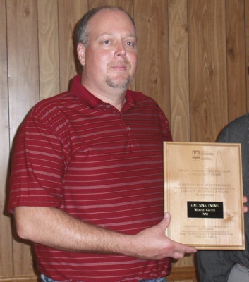
COLDWATER - Elections were held and various awards were given out during the 67th annual Mercer County Soil and Water Conservation District banquet Tuesday.
CELINA - Councilwoman Angie King's request to table a resolution formally opposing the idea of a state takeover of income taxes was shot down by fellow council members this week.
ROCKFORD - Council members on Tuesday agreed to amend a utility ordinance after eight renters left their homes last month without paying utility bills. [More]
FORT RECOVERY - Mercer County Commissioners on Tuesday penned approval of a 10-year real estate tax abatement for a new childcare business in the village.
MINSTER - Beaming from ear to ear and decked out in the dark green of Wright State University, Minster's softball standout Hanna Floyd bounced around Minster High School's library on Tuesday afternoon fielding questions from reporters while awaiting the last of the television cameras to arrive.
The Southwest District had plenty of honors for Midwest Athletic Conference football players as all-district recognition was released on Tuesday evening.