Flood Watch issued September 17 at 2:22AM EDT until September 17 at 2:00PM EDT by NWS Wilmington OH (details ...)
* WHAT...Flash flooding caused by excessive rainfall continues to be possible. * WHERE...Portions of central and west central Ohio, including the following counties, in central Ohio, Delaware, Franklin, Licking, Madison and Union. In west central Ohio, Auglaize, Champaign, Clark, Darke, Hardin, Logan, Mercer, Miami and Shelby. * WHEN...Until 2 PM EDT this afternoon. * IMPACTS...Excessive runoff may result in flooding of rivers, creeks, streams, and other low-lying and flood-prone locations. * ADDITIONAL DETAILS... - Multiple rounds of showers and thunderstorms will move across parts of the area this morning, possibly extending into early afternoon. This may result in bands of heavier rainfall that could lead to flash flooding.
Saturday, June 23rd, 2012
Photo by Nancy Allen/The Daily Standard
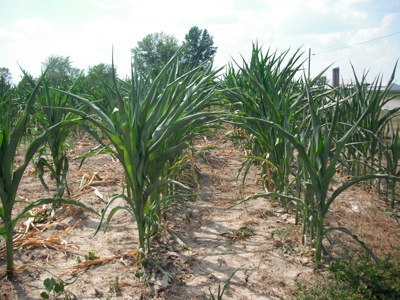
Corn curls in the hot sun Thursday afternoon in a field off Mud Pike west of Celina. Area crops are showing signs of stress, but it is not serious yet, local ag officials say.
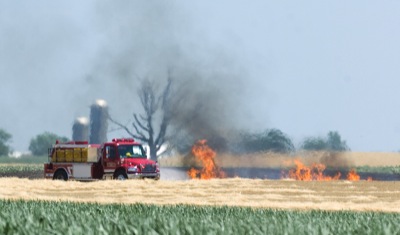
Ongoing hot, dry weather is giving farmers and firefighters a rough time.
More than a dozen mostly wheat field and ditch fires have been reported in Mercer County this week, the 911 log shows. None have been reported so far in Auglaize County. [More]