Special Weather Statement issued May 1 at 12:13PM EDT by NWS Wilmington OH (details ...)
At 1212 PM EDT, a strong thunderstorm was located near New Bremen, moving northeast at 50 mph. HAZARD...Wind gusts up to 45 mph and pea size hail. SOURCE...Radar indicated. IMPACT...Gusty winds could knock down tree limbs and blow around unsecured objects. Hail may cause minor damage to vegetation. Locations impacted include... Newport, Fryburg, Montra, Egypt, Uniopolis, New Bremen, Buckland, Botkins, New Knoxville, Fort Loramie, Kettlersville, Moulton, Jackson Center, St. Marys, Anna, Kossuth, Lakeview, Lake Loramie State Park, Waynesfield, and Wapakoneta. This includes I-75 in Ohio between mile markers 96 and 118. If outdoors, consider seeking shelter inside a sturdy building. To report hazardous weather conditions, go to our website at weather.gov/iln and submit your report via social media, when you can do so safely.
Monday, April 8th, 2013
Photo by Jason Snyder/The Daily Standard
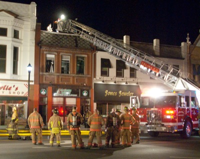
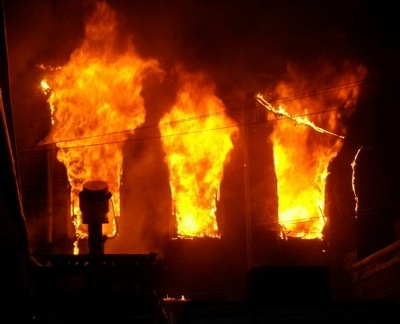
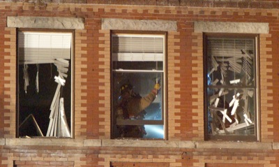
Firefighters from Celina, Montezuma and Coldwater respond to a blaze that started in an upstairs apartment of a downtown building in Celina on Sunday night.
CELINA - A late night fire blazed through the top floor of a downtown building, resulting in a heavily damaged apartment and smoke and water damage to a couple Main Street businesses. [More]