Severe Thunderstorm Watch issued April 27 at 11:27PM EDT until April 28 at 4:00AM EDT by NWS Wilmington OH (details ...)
SEVERE THUNDERSTORM WATCH 165 REMAINS VALID UNTIL 4 AM EDT TUESDAY FOR THE FOLLOWING AREAS
IN INDIANA THIS WATCH INCLUDES 8 COUNTIES
IN EAST CENTRAL INDIANA
FAYETTE UNION WAYNE
IN SOUTHEAST INDIANA
DEARBORN FRANKLIN OHIO RIPLEY SWITZERLAND
IN KENTUCKY THIS WATCH INCLUDES 10 COUNTIES
IN NORTHERN KENTUCKY
BOONE BRACKEN CAMPBELL CARROLL GALLATIN GRANT KENTON OWEN PENDLETON ROBERTSON
IN OHIO THIS WATCH INCLUDES 6 COUNTIES
IN SOUTHWEST OHIO
BUTLER CLERMONT HAMILTON
IN WEST CENTRAL OHIO
DARKE MERCER PREBLE
THIS INCLUDES THE CITIES OF ALEXANDRIA, AUGUSTA, AURORA, BATESVILLE, BELLEVUE, BRIGHT, BROOKSVILLE, BROOKVILLE, BURLINGTON, BUTLER, CAMDEN, CARROLLTON, CELINA, COLDWATER, CONNERSVILLE, COVINGTON, CRITTENDEN, DAY HEIGHTS, DAYTON, DILLSBORO, DOWNTOWN CINCINNATI, DRY RIDGE, EATON, ERLANGER, FAIRFIELD, FALMOUTH, FLORENCE, FORT THOMAS, GREENDALE, GREENVILLE, HAMILTON, HIDDEN VALLEY, HIGHLAND HEIGHTS, INDEPENDENCE, LAWRENCEBURG, LIBERTY, MIDDLETOWN, MILAN, MILFORD, MOUNT CARMEL, MOUNT OLIVET, MOUNT REPOSE, MULBERRY, NEWPORT, OAKBROOK, OSGOOD, OWENTON, OXFORD, RICHMOND, RISING SUN, SUMMERSIDE, VERSAILLES, VEVAY, WARSAW, WEST COLLEGE CORNER, WILLIAMSTOWN, AND WITHAMSVILLE.
Special Weather Statement issued April 27 at 11:00PM EDT by NWS Wilmington OH (details ...)
Wind gusts of 35 to 50 MPH will be possible over the next few hours. These winds will occur separately from any thunderstorms. Winds of this magnitude may damage small tree limbs and make driving difficult, especially for high profile vehicles.
Severe Thunderstorm Warning issued April 28 at 12:25AM EDT until April 28 at 1:00AM EDT by NWS Wilmington OH (details ...)
At 1225 AM EDT, severe thunderstorms were located along a line extending from near Newport to near Eaton, moving northeast at 70 mph.
HAZARD...60 mph wind gusts.
SOURCE...Radar indicated.
IMPACT...Expect damage to trees and power lines.
Locations impacted include... Trotwood, Piqua, Englewood, Greenville, Eaton, West Milton, New Bremen, Minster, Versailles, Covington, Arcanum, Newport, Bradford, Lewisburg, New Paris, Fort Loramie, West Alexandria, Pleasant Hill, New Madison, and New Knoxville.
This includes I-70 in Ohio between mile markers 1 and 26.
Severe Thunderstorm Watch issued April 27 at 11:27PM EDT until April 28 at 4:00AM EDT by NWS Wilmington OH (details ...)
THE NATIONAL WEATHER SERVICE HAS EXTENDED SEVERE THUNDERSTORM WATCH 165 TO INCLUDE THE FOLLOWING AREAS UNTIL 4 AM EDT TUESDAY
IN OHIO THIS WATCH INCLUDES 5 COUNTIES
IN SOUTHWEST OHIO
WARREN
IN WEST CENTRAL OHIO
AUGLAIZE MIAMI MONTGOMERY SHELBY
THIS INCLUDES THE CITIES OF DOWNTOWN DAYTON, FRANKLIN, KETTERING, LANDEN, LEBANON, MASON, MINSTER, NEW BREMEN, PIQUA, SIDNEY, SPRINGBORO, ST. MARYS, TIPP CITY, TROY, AND WAPAKONETA.
61° 61° Tue 72° Tue 72° chance 50° 50° likely Wed 60° Wed 60° likely
Saturday, July 27th, 2013

Coldwater's 175th celebration events

Numerous activities and displays are planned to mark Coldwater's 175th anniversary. The celebration begins Sunday and continues through Aug. 4.
Sunday
• 1:30 p.m. - ice cream social at Coldwater High School auditeria
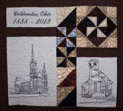
• 1:30-5:30 p.m. - quilt display opens at The Pound at Coldwater Middle School
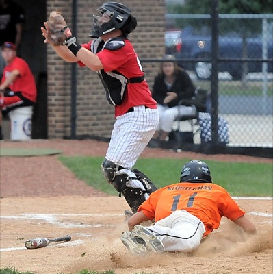
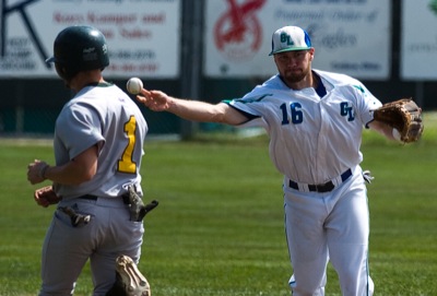
• 2 p.m. - old time baseball game with the Ohio Muffins at Memorial Park (Diamond 3). K-burgers, beer and refreshments will be available
• 2:30 p.m. - vintage fashion show and doll display at high school auditeria
• 7:30 p.m. - opening ceremonies at Cavalier Stadium (Rain date is 7:30 p.m. Monday)
Monday
• 1-8 p.m. - historical display at Fraternal Order of Eagles Hall
• 1-8 p.m. - military display at American Legion Post 470
• 7:30 p.m. - rain date for opening ceremonies at Cavalier Stadium
Tuesday
• 1-8 p.m. - historical display at Eagles
• 1-8 p.m. - military display at American Legion
• 4-8 p.m. - quilt display at The Pound at Coldwater Middle School
• 6-10 p.m. - Taste of the Town downtown featuring local restaurants, live music, wine tasting, beer garden, refreshments and more with presale tickets available at Taste of the Town participants, The Peoples Bank and village offices
• 7-9 p.m. - Off Beat performs downtown
• 7:30 p.m. - beard judging contest downtown
• 8 p.m. - live auction featuring commemorative 175th anniversary steins downtown
Wednesday
• 1-8 p.m. - historical display at Eagles Hall
• 1-8 p.m. - military display at American Legion
• 4-8 p.m. - quilt display at The Pound at Coldwater Middle School
• 5 p.m. - registration opens for scavenger hunt downtown near the corner of First and Main streets
• 6 p.m. - scavenger hunt throughout the village
• 7-9 p.m. - Big Band Night downtown featuring the 11-piece band One More Time. Beer garden and refreshments will be available.
Thursday
• 1-8 p.m. - historical display at Eagles
• 1-8 p.m. - military display at American Legion
• 4-8 p.m. - quilt display at The Pound at Coldwater Middle School
• 6 p.m.-dark - family fun night at Memorial Park (Diamond 8) with cricket matches, circus workshop and refreshments
• Dusk - movie "Wreck it Ralph" at Memorial Park (Diamond 8)
Aug. 2-4
• 53rd annual Coldwater Community Picnic festivities. For more information visit www.coldwaterpicnic.com
Additional online story on this date
ACME State Tournament
COLDWATER - The winding road Coldwater has taken through the ACME state tournament has finally straightened out toward the Cavaliers' ultimate goal. [More]
Subscriber and paid stories on this date
COLDWATER - Colorful quilts - many from bygone days - fill the Coldwater Middle School multipurpose room as part of the community's 175th celebration.
New attractions planned; nice weather in forecast
WAPAKONETA - The 161st annual Auglaize County Fair begins Sunday with new attractions and a promising weather forecast.
The annual event, with acti
Compiled By Gary R. Rasberry
Needing just one win of Friday's doubleheader to ensure a Great Lakes Summer Collegiate League playoff berth, the Mariners did it in style.