Severe Thunderstorm Warning issued August 11 at 8:23AM EDT until August 11 at 9:00AM EDT by NWS Wilmington OH (details ...)
At 823 AM EDT, a severe thunderstorm was located near St. Henry, moving southeast at 40 mph.
HAZARD...60 mph wind gusts.
SOURCE...Radar indicated.
IMPACT...Expect damage to trees and power lines.
Locations impacted include... Coldwater, Versailles, St. Henry, Bradford, Webster, Gettysburg, Osgood, Chickasaw, Burkettsville, North Star, Montezuma, New Weston, Yorkshire, Darke County Airport, Maria Stein, Brock, State Route 47 at US Route 127, Eldora Speedway, Carthagena, and Willowdell.
Severe Thunderstorm Warning issued August 11 at 8:18AM EDT until August 11 at 9:00AM EDT by NWS Wilmington OH (details ...)
At 817 AM EDT, severe thunderstorms were located along a line extending from near Union City to 7 miles southeast of Muncie, moving southeast at 40 mph.
HAZARD...60 mph wind gusts.
SOURCE...Radar indicated.
IMPACT...Expect damage to trees and power lines.
Locations impacted include... Richmond, Greenville, Centerville, Arcanum, Hagerstown, Union City, Fort Recovery, Ansonia, New Madison, Fountain City, Dublin, Franklin, Wayne Lakes, Gettysburg, Greens Fork, Pitsburg, Bethel, Hollansburg, Rossburg, and Palestine.
This includes I-70 in Indiana between mile markers 134 and 148.
Flood Watch issued August 11 at 4:12AM EDT until August 12 at 8:00AM EDT by NWS Wilmington OH (details ...)
* WHAT...Flash flooding caused by excessive rainfall continues to be possible.
* WHERE...Portions of Indiana, including the following counties, Dearborn, Fayette, Franklin, Union and Wayne, Kentucky, including the following counties, Boone, Bracken, Campbell, Kenton, Lewis, Mason, Pendleton and Robertson, and Ohio, including the following counties, Adams, Auglaize, Brown, Butler, Champaign, Clark, Clermont, Clinton, Darke, Delaware, Fairfield, Fayette, Franklin, Greene, Hamilton, Hardin, Highland, Hocking, Licking, Logan, Madison, Mercer, Miami, Montgomery, Pickaway, Pike, Preble, Ross, Scioto, Shelby, Union and Warren.
* WHEN...Through Wednesday morning.
* IMPACTS...Excessive runoff may result in flooding of rivers, creeks, streams, and other low-lying and flood-prone locations.
* ADDITIONAL DETAILS... - Several rounds of thunderstorms are expected into Wednesday morning. Locally heavy rainfall can be expected with the potential for storms to repeatedly track over the same locations. This will result in the potential for flash flooding.
Severe Thunderstorm Warning issued August 11 at 8:34AM EDT until August 11 at 9:15AM EDT by NWS Wilmington OH (details ...)
At 834 AM EDT, a severe thunderstorm was located over Fort Loramie, moving east at 45 mph.
HAZARD...60 mph wind gusts.
SOURCE...Radar indicated.
IMPACT...Expect damage to trees and power lines.
Locations impacted include... Troy, Sidney, Piqua, New Bremen, Minster, Covington, Newport, Bradford, Anna, Fort Loramie, Jackson Center, Pleasant Hill, Botkins, New Knoxville, Hardin, Russia, Laura, Fletcher, Port Jefferson, and Casstown.
This includes I-75 in Ohio between mile markers 71 and 106.
Special Weather Statement issued August 11 at 8:34AM EDT by NWS Wilmington OH (details ...)
At 834 AM EDT, a rapidly developing thunderstorm was located near Chippewa Park, moving east at 45 mph.
HAZARD...Wind gusts up to 50 mph and half inch hail.
SOURCE...Radar indicated.
IMPACT...Gusty winds could knock down tree limbs and blow around unsecured objects. Hail may cause minor damage to vegetation.
Locations impacted include... Bellefontaine, Kenton, Richwood, Russells Point, Lakeview, Alger, Belle Center, West Mansfield, Chippewa Park, Northwood, Blanchard, Roundhead, Mount Victory, Rushsylvania, Mcguffey, Huntsville, Ridgeway, Zanesfield, Raymond, and New Jerusalem.
If outdoors, consider seeking shelter inside a sturdy building.
To report hazardous weather conditions, go to our website at weather.gov/iln and submit your report via social media, when you can do so safely.
Today 83° Today 83° chance 66° 66° chance Tomorrow 83° Tomorrow 83° slight chance slight chance 66° 66° chance likely
Saturday, November 1st, 2014
By Kathy Thompson
MINSTER - Friday was bittersweet for Randy Houseworth as the Minster police chief took off his badge and retired after serving in law enforcement since 1978.
"I'm ready to do something else," Houseworth, 59, said. "(I) don't have any big plans for anything right now except to maybe relax and travel a little."
Houseworth said he's worked with a "great bunch of people" throughout the years and will miss the companionship among the other officers and village administrators. [More]
By Dave Stilwell
MARIA STEIN - Marion Local put an exclamation mark on its second consecutive undefeated regular season with a 50-0 victory over Delphos St. John's in the midst of a Halloween blizzard Friday night at Booster Field.
The Flyers also wrapped up their second straight outright Midwest Athletic Conference title, no small feat for the three-time defending State Champs. [More]
Obituaries on November 1st, 2014
Velma M. Bergman, 92, Maria Stein, died at 5:40 a.m. Oct. 31, 2014, at The Gardens of St. Henry. [More]
Andrew L. Kramer, 86, Chickasaw, died Oct. 30, 2014, at Heritage Manor Nursing Home, Minster. [More]
James R. Ruck, 76, St. Marys, died at 3:52 p.m. Oct. 30, 2014, at Lima Memorial Hospital. [More]
Joseph V. Tangeman, 59, Gahanna, died Oct. 29, 2014, at Select Specialty Hospital, Columbus. [More]
Local pictures on November 1st, 2014
Subscriber stories on November 1st, 2014
Thousands of registered voters in Mercer and Auglaize counties have already cast their ballots ahead of Election Day on Tuesday.
As of Friday afternoon, 3,270 absentee ballots were issued in Mercer County, according to board of elections directors Deb Sneddon and Laura Bruns.
Tigers clinch playoff spot with 20-0 win
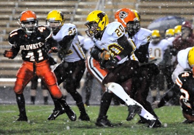
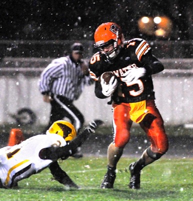
FORT RECOVERY - As if playing Versailles wasn't enough of a challenge, lining up against Mother Nature proved to be a bigger foe.
The windy and ra
Compiled by Gary R. Rasberry
Elida scored on touchdown runs by Logan Alexander and Clark Etzler and the weather shut down Celina's passing game in a 15-6 loss in the battle of Bulldogs in the regular season finale at Kraft Stadium.
ANNA - The St. Henry football team began its quest for Week 11 during hot summer months.
The Redskins finished off their regular season campaign w
It was a good night for the MAC as the conference managed to slip six of its 10 teams into postseason play. Marion Local, Coldwater and Minster will be hosting playoff games, while Fort Recovery, Versailles and Delphos St. John's will be traveling for their week 11 games.
Western Buckeye League Roundup
Compiled by Gary R. Rasberry
Isaac Fitzgerald completed his high school football career with an exclamation point as St. Marys finished the season at 5-5 with a 39-14 win over Van Wert at Eggerss Stadium in Van Wert.
Midwest Athletic Conference Roundup
Compiled by Gary R. Rasberry and
Bruce Monnin
Brody Hoying threw for three touchdowns and ran for another as Coldwater wrapped up a home playoff game with a 47-0 win over New Bremen on Friday night at Cavalier Stadium.